Contents
Planning
Our Ride
We hatched a plan back in October 2019, to use the opportunity created by the NI1600’s double badger ride, to do another IBA certified ride.
Stella and I have been making good progress through the IBA four season’s certificates and knew that we would have completed the Summer, Winter and Spring rides by the time that summer (2020) rolled around again. So we set our sights on getting the Double Badger ride done in Autumn, March 2020.
We were allowed to finish the double badger at any time over the 12 months following on from the event which was on the first week of October 2019.
Our Group
Luke and Tania Mitchell had also taken part in the NZ Distance Riders’ event in October 2019, with all of us sensibly opting to do the NI800 ride on the day of the event, postponing our longer ride’s effort until the days were longer and the weather was expected to be better. While the NZDR organisers don’t allow pillions during their event, we made a case stating that we’d done LD rides with the pillions before, and that since we were doing this outside of the event, and in our own time, that we’d be happy to take overall, full responsibility for what we were doing. – It was accepted (without setting any precedent), for us to do this. So the girls were going to be joining us both on the back seats.
Stella rode the NI800 and has since ridden a SS1600K ride (SantaSore – on Christmas Day), but since we were aiming to use this ride as our Fourth Season’s ride, we needed to make this one consistent with the other three, in which she’s been on the back of the C14.
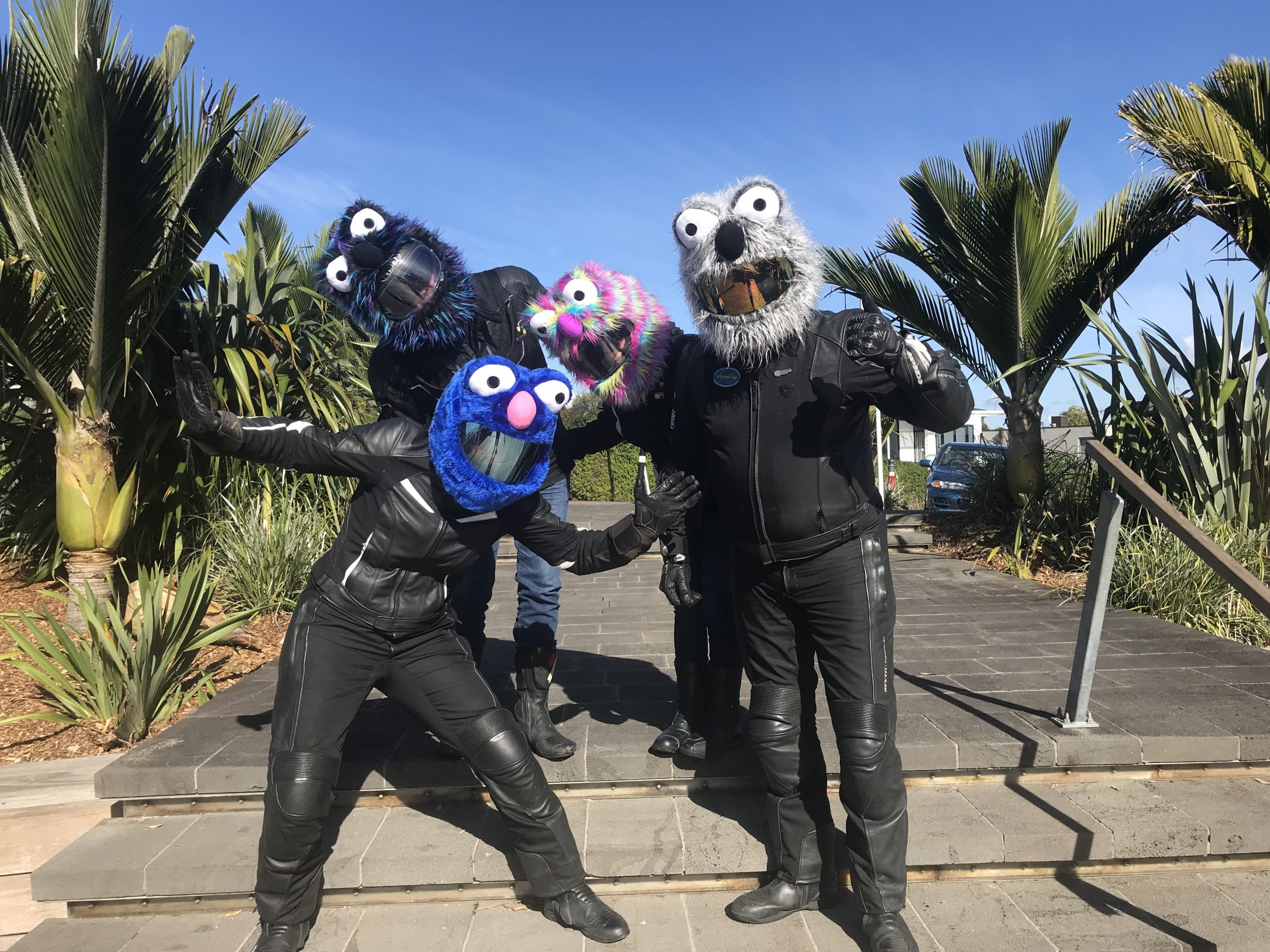
What a bunch of muppets!
So, we had a plan and we knew what we wanted to do. – All for of us are roughly Auckland based, so we set about planning a reasonable route, based on the NI1600 ride requirements.
Routing and Timing
I’ve been in touch with John Maroulis over the past few months over a number of things, and through this we got talking about the expectations for the NI1600 ride. In the past they’ve made customised concessions for people who are having to ‘ride-in’ to the route, allowing certain aspects to be curtailed as the distance would have ended up greatly exceeding 1609km from various start points.
We checked what his expectations were and he made a few suggestions to us about which areas we might drop off our route. The down and back up from Turangi was one of those sections, and in doing that it also meant changing the next checkpoint’s order and picking it up slightly earlier in the ride. – Having done this, we needed a little bit more distance, and so we added in a little back-country loop into the mid-morning section of the ride. We then looked critically at whether returning up through SH22 at the very end of our ride was a good idea or not. – We have just ridden through that section of rode when returning home from the TT, and know that the road isn’t in the best of conditions at this point, with a number of areas of subsidence. Doing this tired and in the dark at the end of our 1600km ride didn’t seem like the best plan, and so we applied for dispensation to drop that section from our route too. John was happy with what we had proposed. We were looking at around 21 hours, and ~1635km.
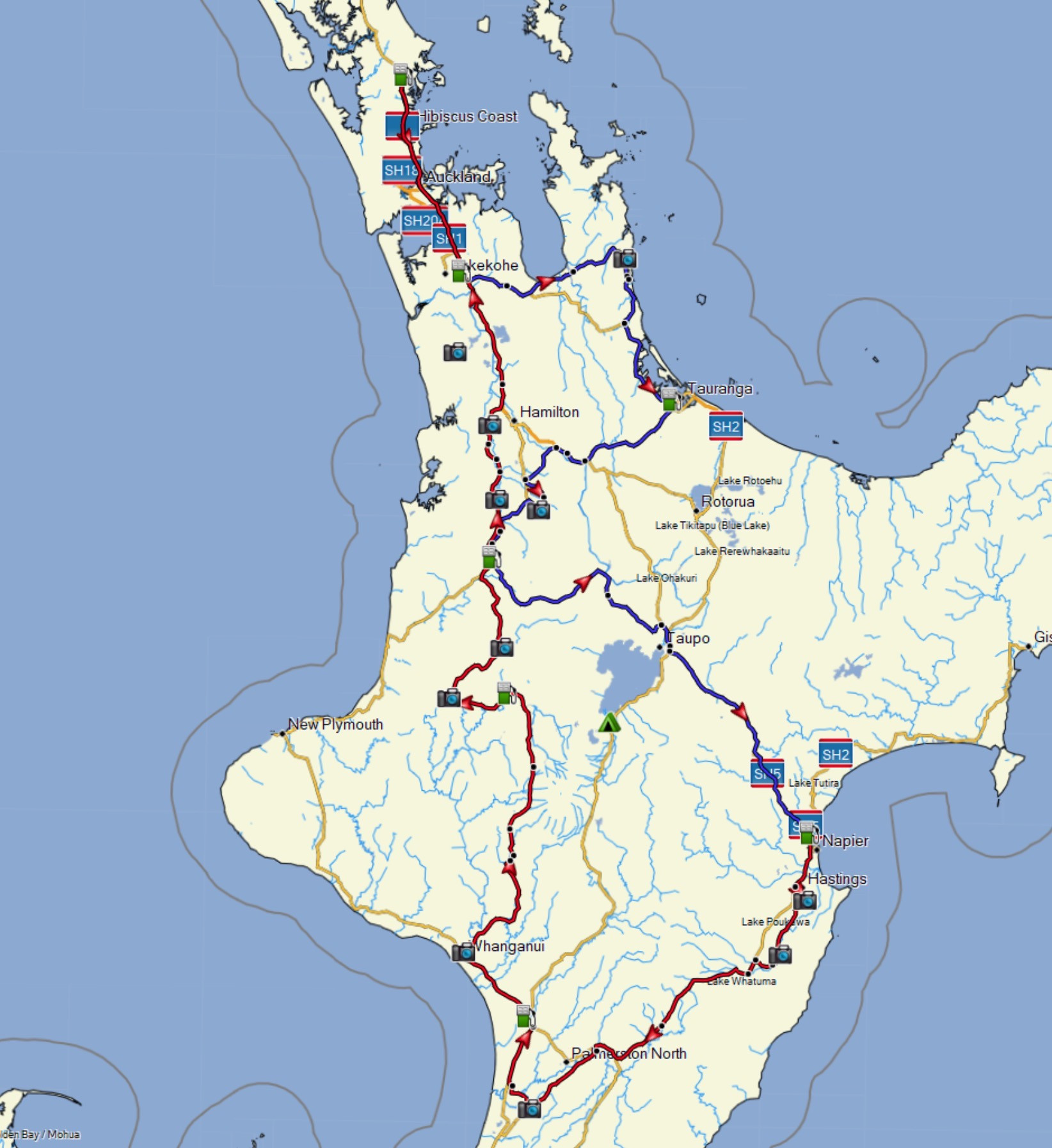
We had made efforts to keep most of the key-routing components of the original route in place. – 25A, back country over to Te Kuiti, back country through to Taupo, over SH5, down to Shannon, back up through the Paraparas now that they had re-opened, Ohura loop, back-country through the Waikato, then straight up to Auckland / Warkworth or a finish.
GPS updates
There were two issues with the maps I was using for planning and on my GPS, the Paraparas were not routing (they were flagged as closed still), and the Waikato Expressway (Huntly bypass) was not active yet on my maps. I went online to download new OSM maps and noticed that the Paras were still shut, but that the Waikato Expressway was shown as open. What to do? – I still had about a week or so before our ride, so I chose to learn a little about the OSM (Open Source) approach to building and maintaining maps.
OSM stands for Open Street Maps, it is a community based, open source collection of mapping data, sourced from public resources, and maintained by the community. It’s an incredibly powerful and responsive approach, as I was about to find out. With the freshly downloaded OSM map, the first thing to do was to consider whether the true OSM source also still contained the issue or whether it simply a problem with ‘lag’, through to my OSM source.
The way that OSM works, is that there is a master OSM repository of OSM data, weekly they publish full extracts of content, then from that they publish updated extracts (difference files). There are also API interfaces which allow developers to pull specific updates out of the OSM repositories. In essence, members of the public, like me and you, COULD pull a full set of content from the source, but we’re unlikely to. There is a lot involved in getting your own system setup to generate and pull that content. Instead, we’re likely to interface with some intermediary systems and to consume extracts that they have obtained. The timing, and the content within these extracts can vary, and so finding a good, and well suited source of an extract takes some research and figuring out…
Anyway, I digress – I was in the midst of trying to check the source; the way to do that is to setup an account here: https://www.openstreetmap.org – and then search for the sections of the map in the master system. The bit of road which was incorrectly flagged as closed was here, between Whanganui and Raetahi:
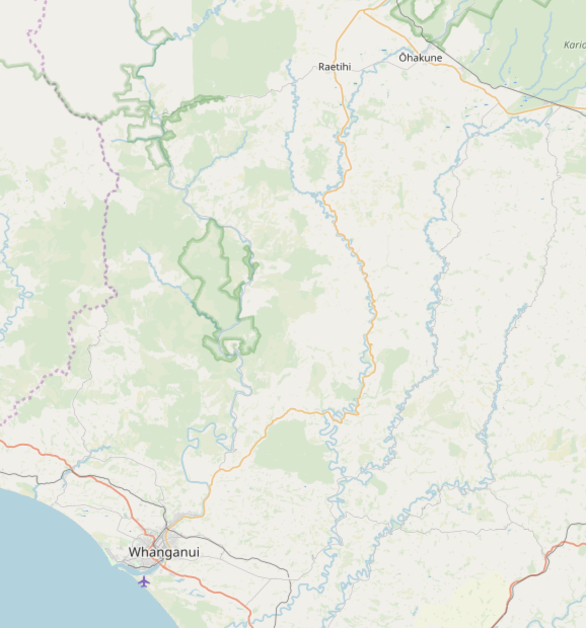
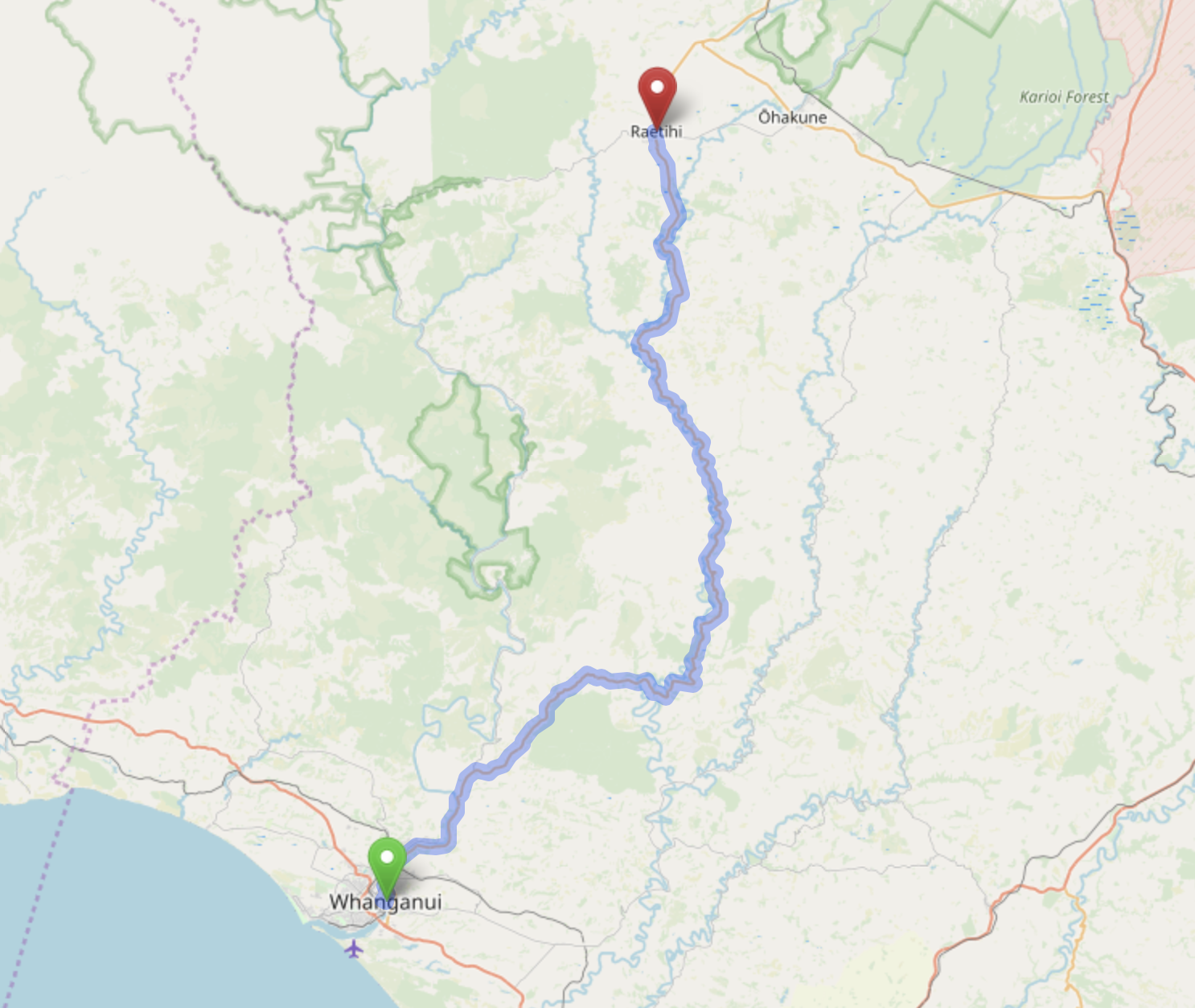
When I checked the routing on this map, it showed the same issue as I had experienced within Basecamp’s version of the OSM map, it sent me around Field Tracks. The below image shows what we get now (it’s fixed):
When I did this before, it wasn’t like this… So I zoomed in and zoomed in, and found the area which was closed and which created the diversion.
There is a ‘History View’ available through OSM which shows you all alterations made to areas on the map, so by extending the history view back, and back and back further to the time when the road was closed, I was able to find the change which was made to the map originally when the slip had occurred, I remember when this was, because it was just before the NZDR NI event in October, 2019! – That made it easy for me to locate it. Once I’d found the change which closed the road, it was super easy for me to add a comment into that modification, and to notify the person who made that change, that the road was no longer temporarily closed, and that it had actually re-opened on ~19th December last year.
https://www.openstreetmap.org/changeset/82019620#map=14/-39.5758/175.2818
And this is where the power of the community comes into play, I didn’t have any knowledge about how to make the change to re-open it, but I could play my own part by appropriately bringing this to the attention of some people who clearly did know (since they had made it inaccessible originally). – They were happy to be informed of the required alteration and within 8 hours from me lodging those comments, their change had been committed back into the main OSM source data. From that point, there is nothing more that needs to be done, in order for those modifications to be brought out through the Extracts. Generally others in the community check updates which have been made by other active people and anything which is erroneously done doesn’t stay in the master for very long. – So it’s never guaranteed to be 100% accurate, but the quality of the maps, with an active and fluid community making changes like this, is very high. And certainly all ‘real-issues’ those which cause someone like me to raise a flag for a change, they get fixed super quickly.
So, after that, it was just a case of finding a routinely updated extract from the master collection, and then getting it back into my BaseCamp, and onto my GPS.
My normal source of OSM content does not get updated daily, it’s more like weekly from the main updates, then it seems it can be almost monthly for regional updates beyond that… With only a week before our ride, that wasn’t going to work for me. – So, with hope that I would get a fully working map before our ride, I reverted back to an older version of the OSM map for planning purposes, one which had the Paras open (from before the closure). That was good enough for the immediate term.
In the meanwhile, I waited and watched the extract sites, and found one option which was only around 2 days of lag for our NZ region. – This was an OSM Extract source though, and did not go to the further lengths of compiling the OSM map data into usable formats for both BaseCamp and my GPS. – Both of those two require the OSM content to be packaged up into specific formats.
Thankfully, there are really good online resources for this, which provided enough of a walk-through, step by step example of how to accomplish packaging downloaded OSM content into the required formats… There is a whole blog post on that subject here: Custom building our own NZ based OSM maps…
For those quirky enough to want to know how it’s done, that might be worth a read… For everyone else, just know that at that point, about 5 days out from our ride, I managed to build my own set of new GPS maps for the Garmin and the RoutePlanning software: BaseCamp. – This was the first time I’ve ever done this, and in building them I had reviewed the ‘routing speed config’ file within the packaging software. I had lowered the GPS’s interpretation of road speeds to be cautious, so as not to allow my GPS to think that we were capable of European highway speeds here on our ‘State Highways’. I needed to test this, and so during the week before our ride, I took the newly added maps on the GPS into work and watched the Arrival ETA estimate. It was bloated. I had made it too slow… 🙁 – I was clawing back around 1 minute every few kms. Clearly I had over-done it and needed to re-build those maps again for use on our ride.
I did this, because it’s taken me a while to find a good source of maps where the GPS based maps actually pretty well match my own personal riding speeds and style, and once I had found that I recognised how good it was to have a GPS which gave you a good and reasonably accurate ETA on your next checkpoint. LD riding for me is all about getting into a good and solid pace, and being able to know with some certainty where you are against your ride-plan. If you have to wait a full tank’s distance before you can check yourself off against that planned arrival time (because your GPS is rubbish at forecasting it), then you can find that you increasingly get further and further away from your planned timings. If you have a good ETA, and if it doesn’t generally drift too much when you’re riding then it helps tremendously.
My old source of maps had become a really good and reliable source for accurate route timing in NZ, and so I did make the effort, 2 days prior to our ride, too work through the process of re-building those two sets of maps.
It was only at this point that I could use the correct sets of maps in BaseCamp to route the planned ride fully, and to obtain final and hopefully accurate timings and distances for our ride plan.
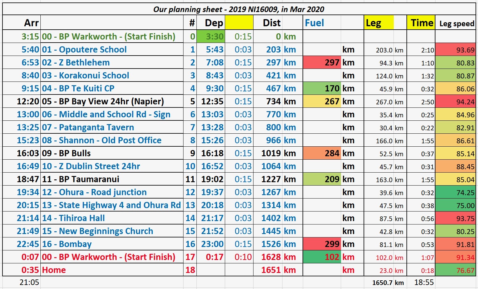
Luke and Tania live on the North Shore, we live on the West Coast, almost level with Warkworth. I had started planning this all just before Luke and Tania were able to confirm that they could come on the ride on that specific date. Given that we live ~50km apart we came up with a cunning plan to level the distance for us all. We had 23km to go to get to Warkworth, they had 43km to get there, so they would run the entire day 20km ahead of our mileage, but then stop short on the way back through. We would do the whole ride, from home, to Warkworth, around the route, then back to Warkworth, then back home. They would do their home, to Warkworth, around the whole route, then likely stop short as they passed by their home, ending their ride before our Warkworth finish. This would net us all about the same, 1,630km, giving us all a reasonable buffer of kms for both the NI1600 and the IBA ride submissions. Our plans had us leaving our respective houses in time to get together at Warkworth for 03:15am.
The ride
We both use SpotWalla, and SWConnect on our iPhones, Stella would be tracking too on her iPhone. So we set the tracking off before we left our respective homes, and managed to capture the route through SpotWalla. If you don’t know anything about SpotWalla, then there are multiple posts on this site about that system, how to use it etc… For LD riders, it is an excellent, trusted source of tracking information for riders. Here’s a search link for SpotWalla information on this site.
In addition to this, Luke and I were both running Rever, I had my GPS creating a back-up track too. We had our planned routes pre-loaded as background traces in Rever. We had also pre-loaded TomTom Go on our iPhones with all of our checkpoints and fuel-stops in numbered order. We had backups for our backup systems, along with the paper based checkpoint book from the NI1600 event too. We had on-board chargers and at least two backup battery banks for charging if the onboard stuff failed, we also had a number of charging cables for various things… Fair to say, we’ve done this before and we didn’t want the technical stuff to be the downfall of recording our ride. All of the trackers were kicked off as we left our respective homes. And this time, unlike the TT, I remembered to zero my GPS trip data at the beginning of the ride, not 22kms into it. 🙂
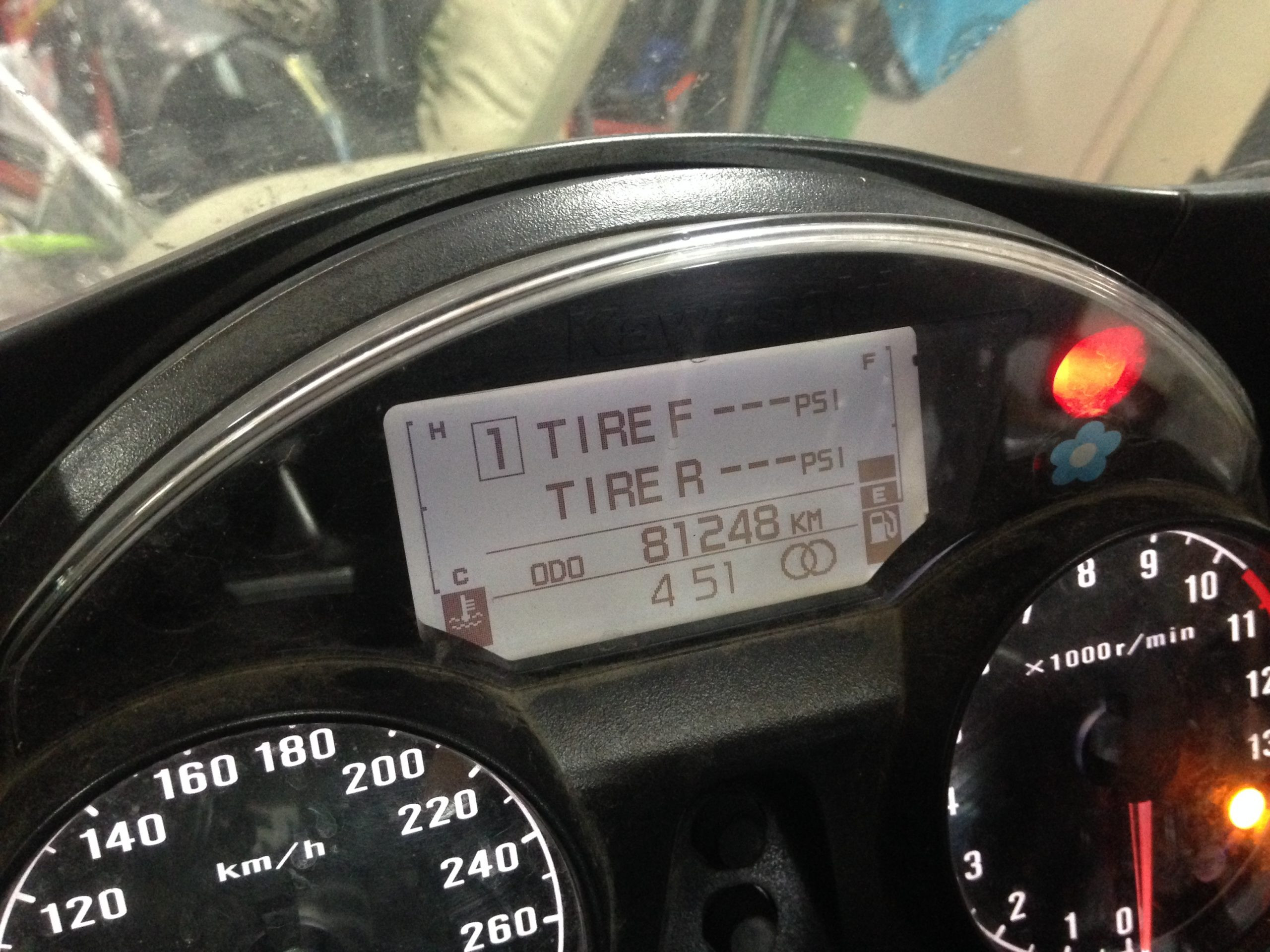
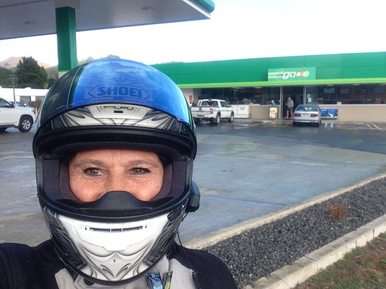
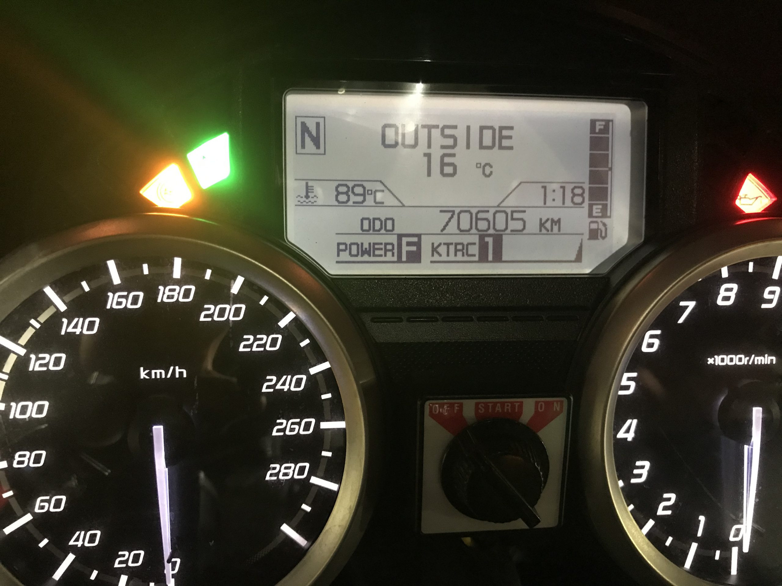
The C14 ODO on Thursday night before we started (at Home)
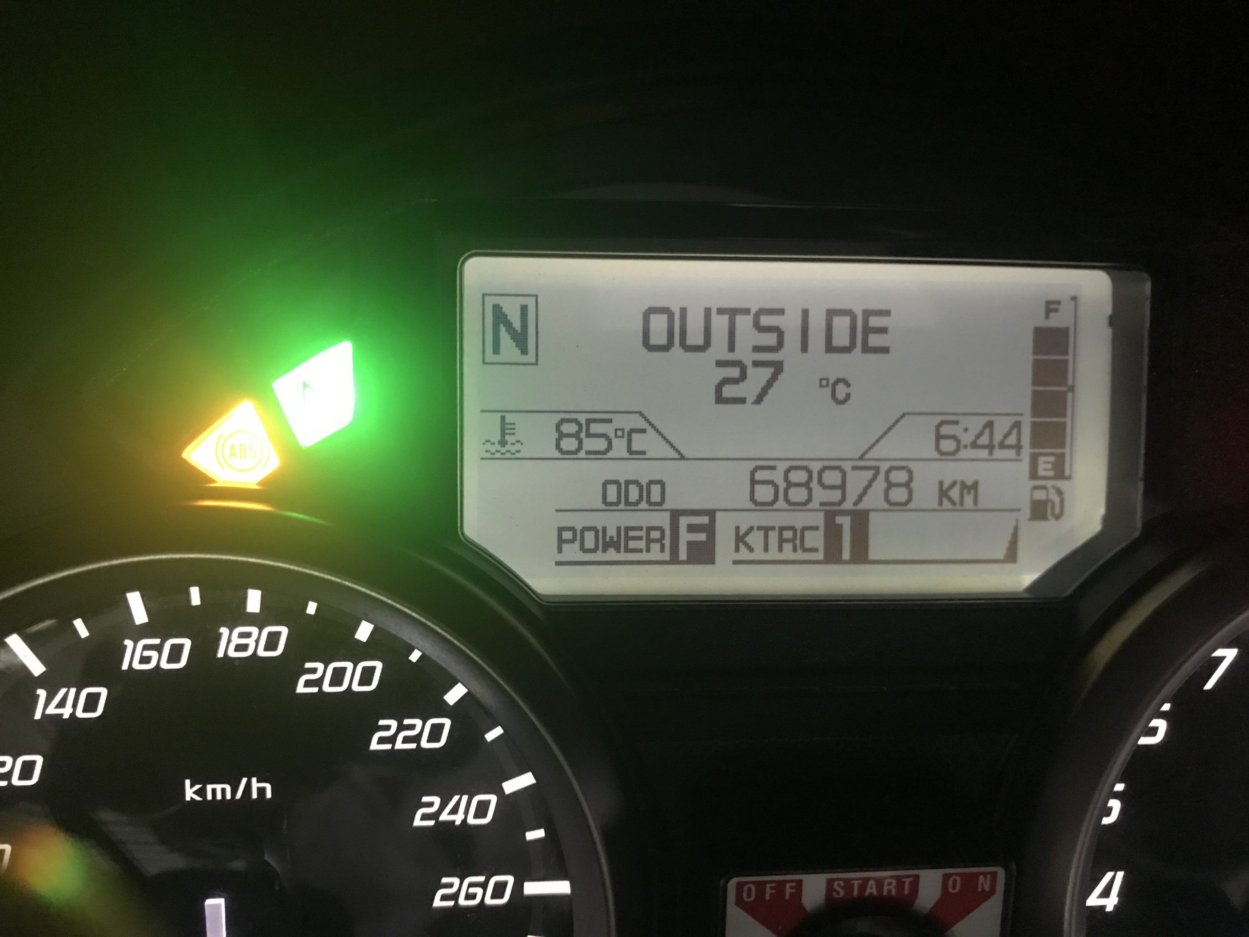
Luke’s starting ODO reading at home, also on Thursday night.
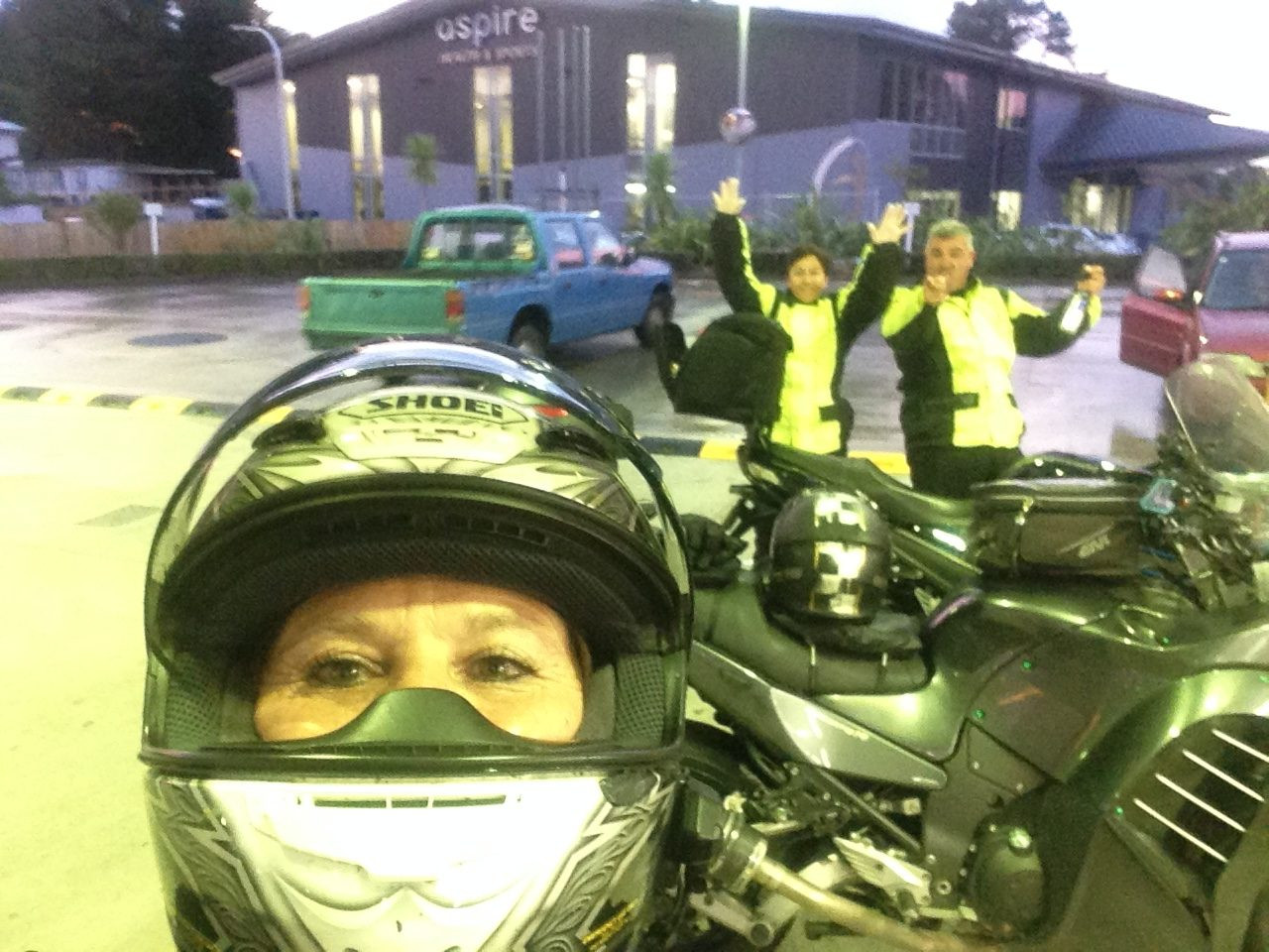
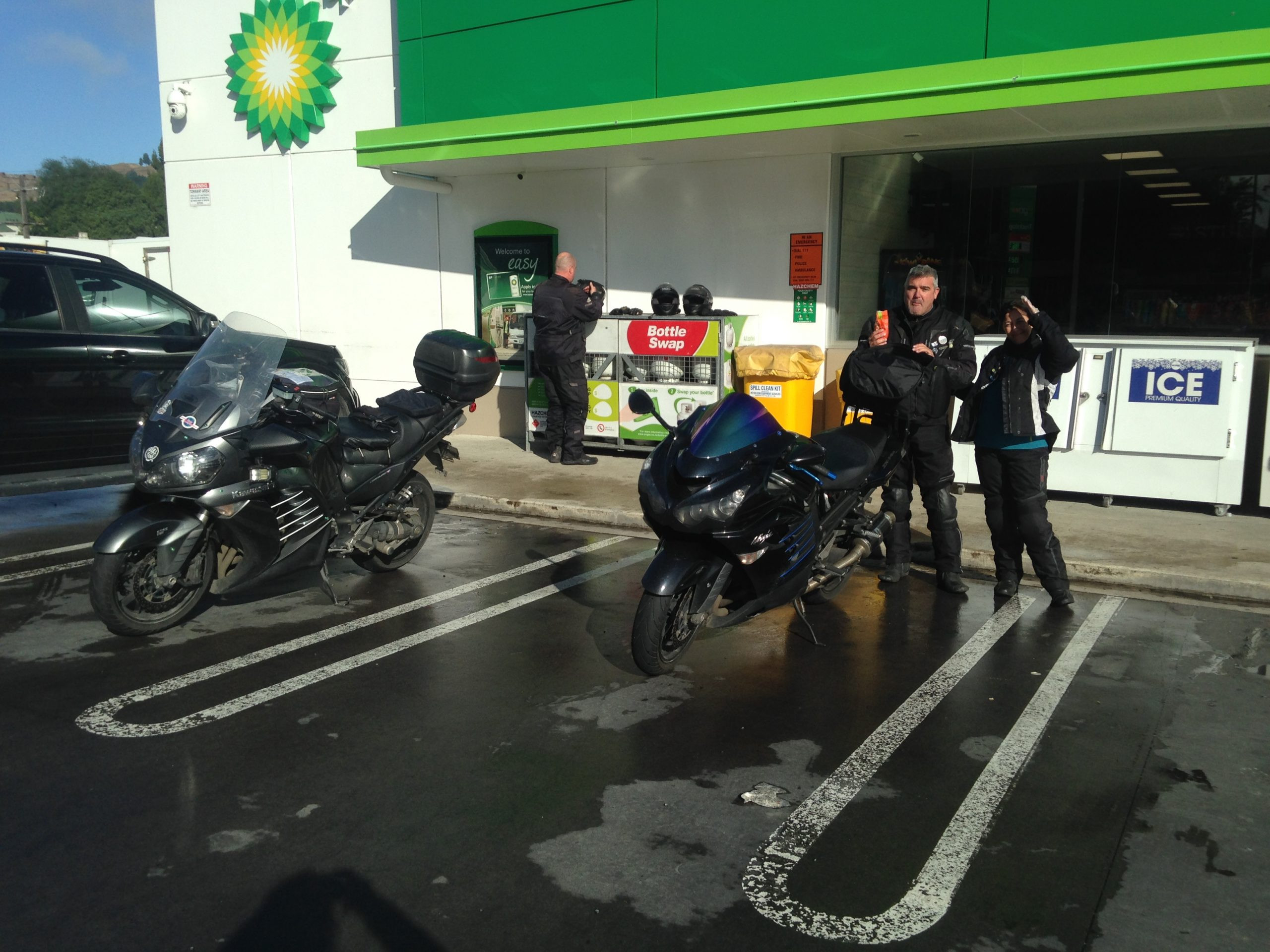
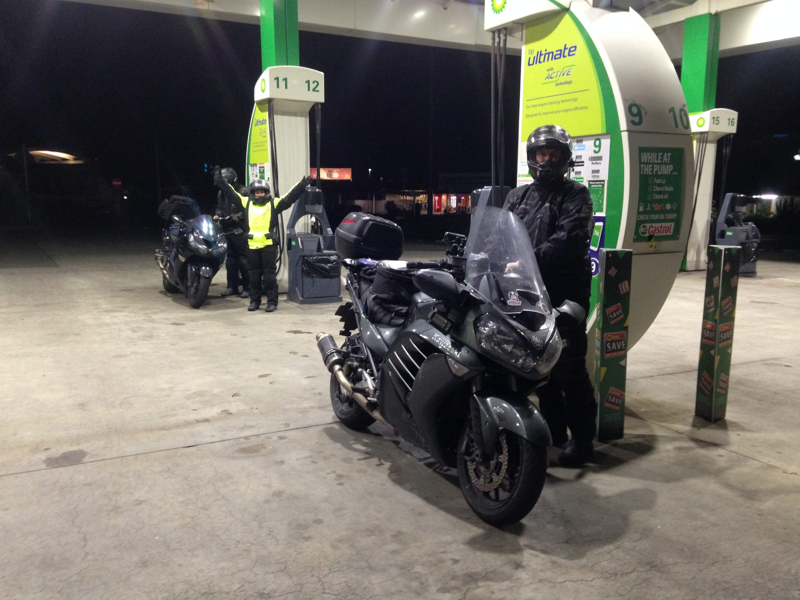
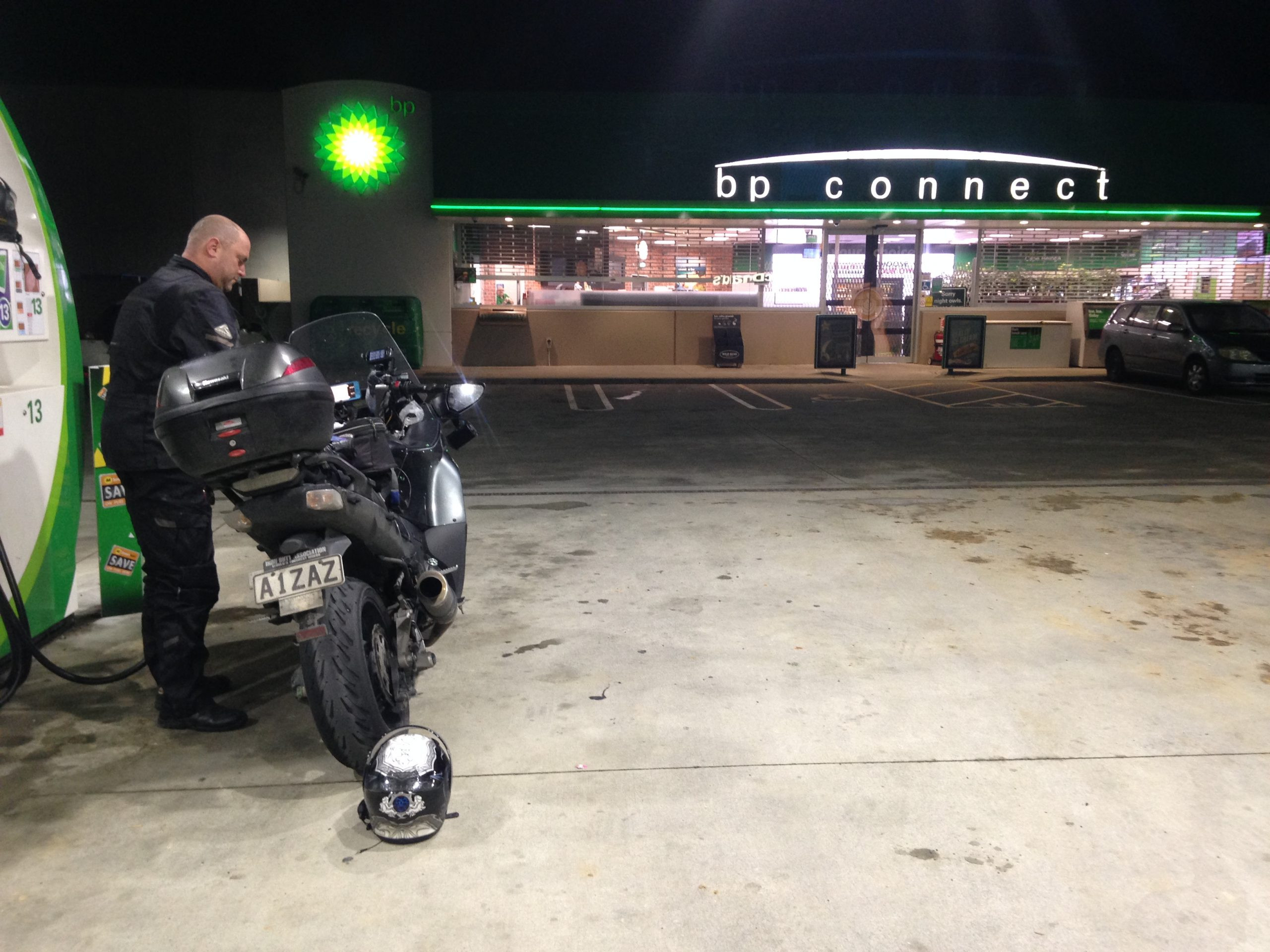
We arrived in Warkworth just a minute or so early, with Luke and Tania turning up on time. We’ve got a communication system which allows all four of our to have a joint – party line style of open channel intercom across the four of us, so we spent a little time messing around getting that going, we checked our SpotWalla tracks were all working properly.

The four of us ready to leave from Warkworth.
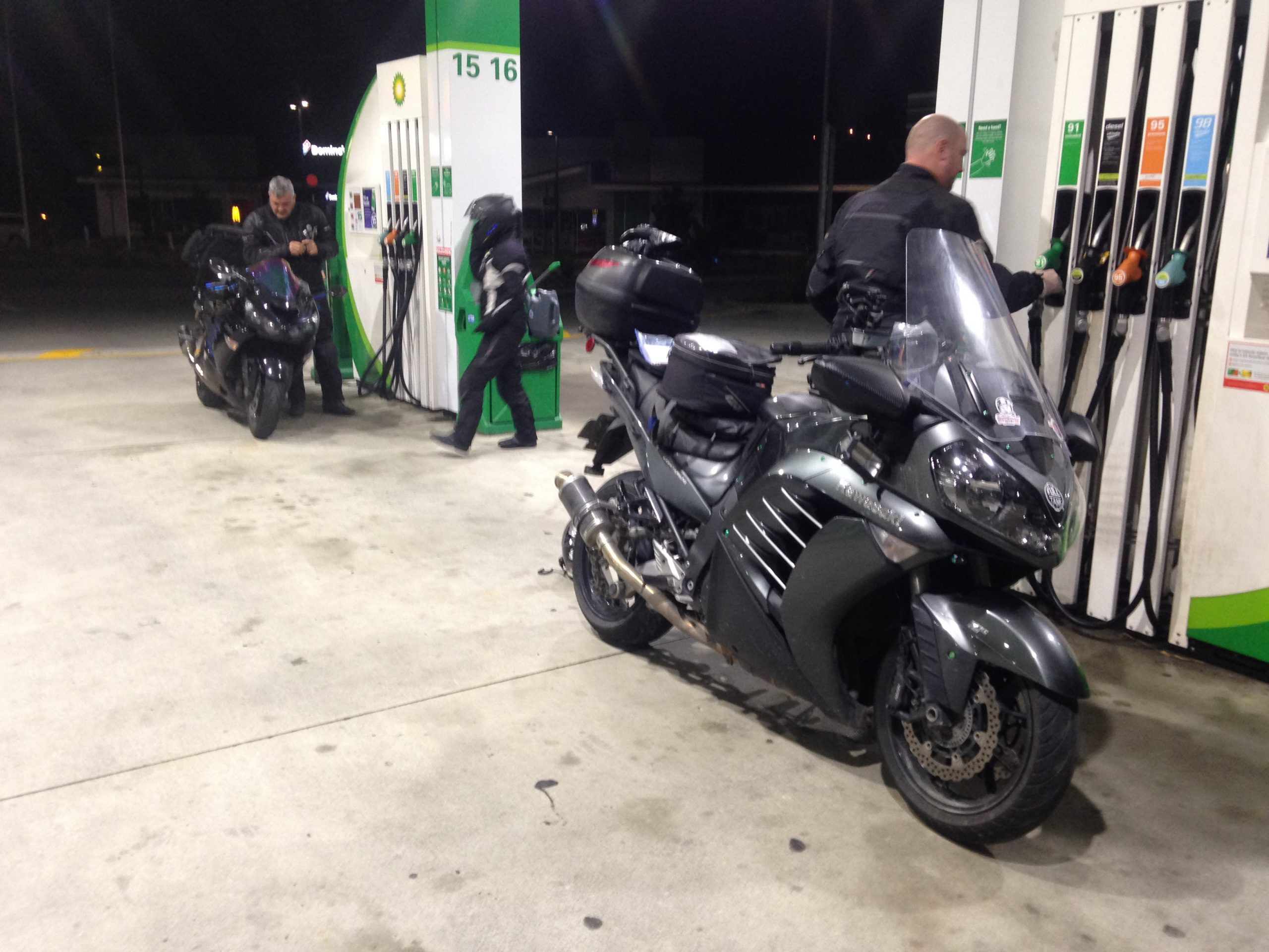
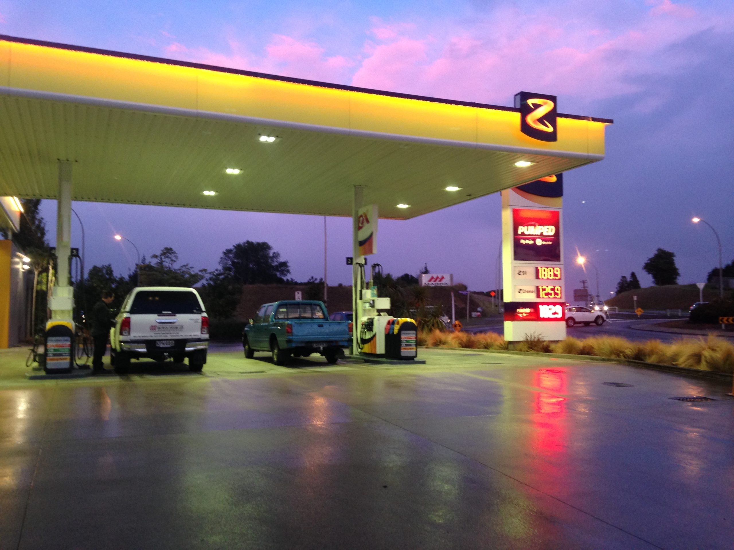
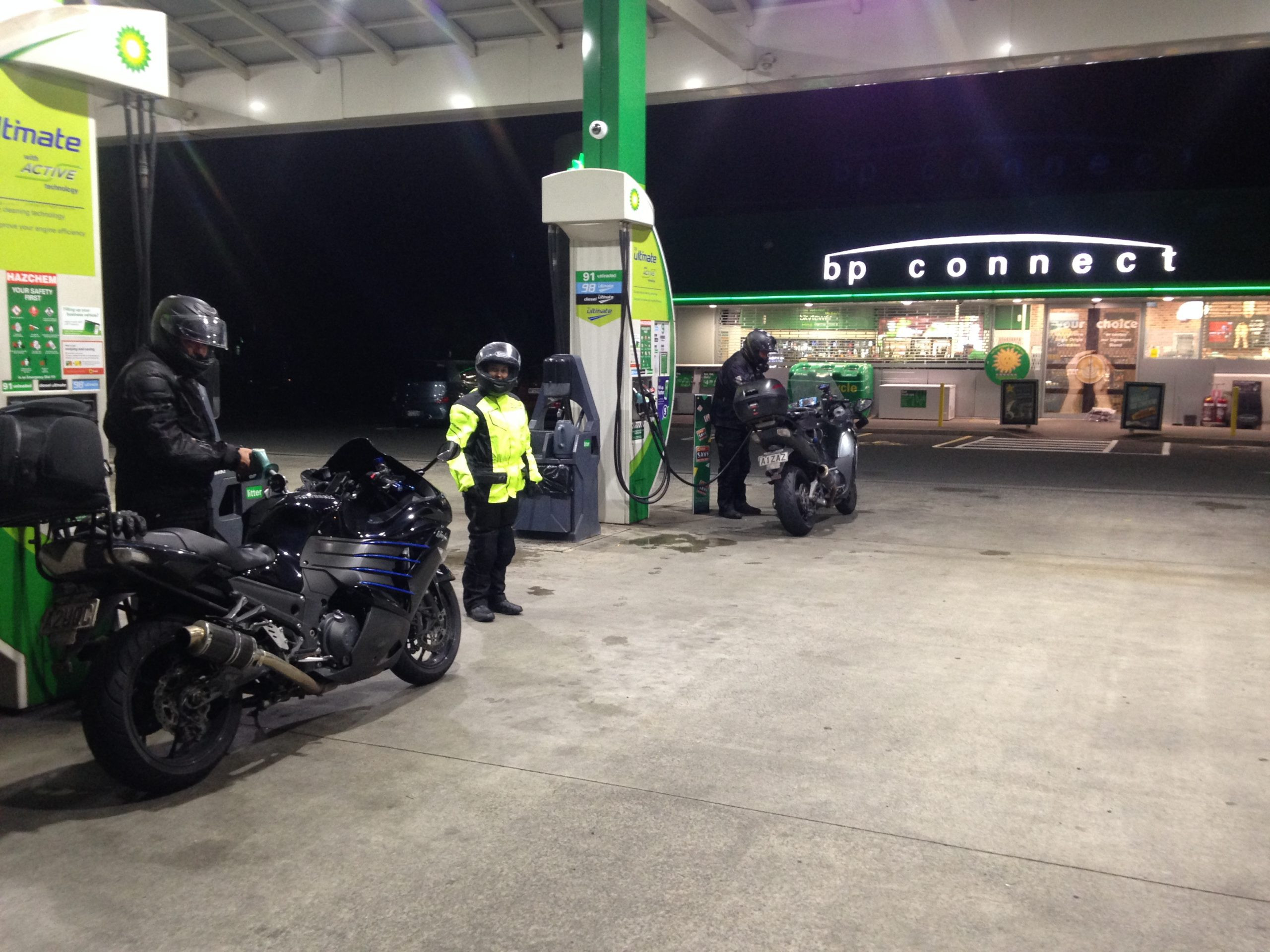
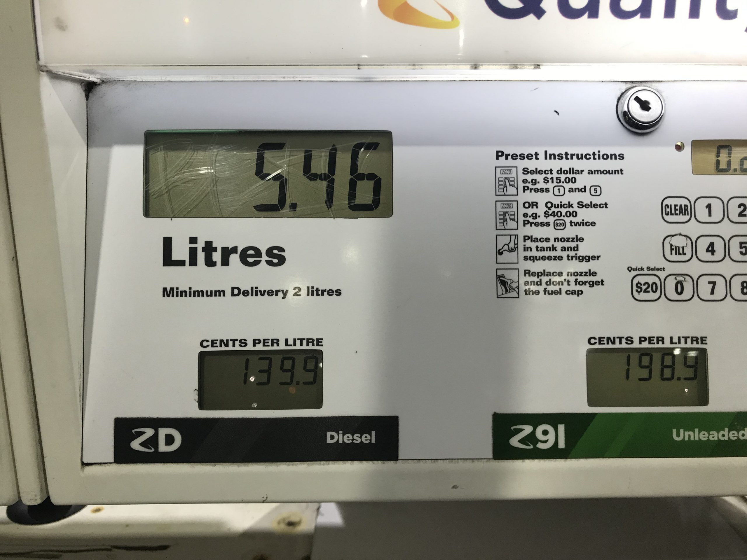
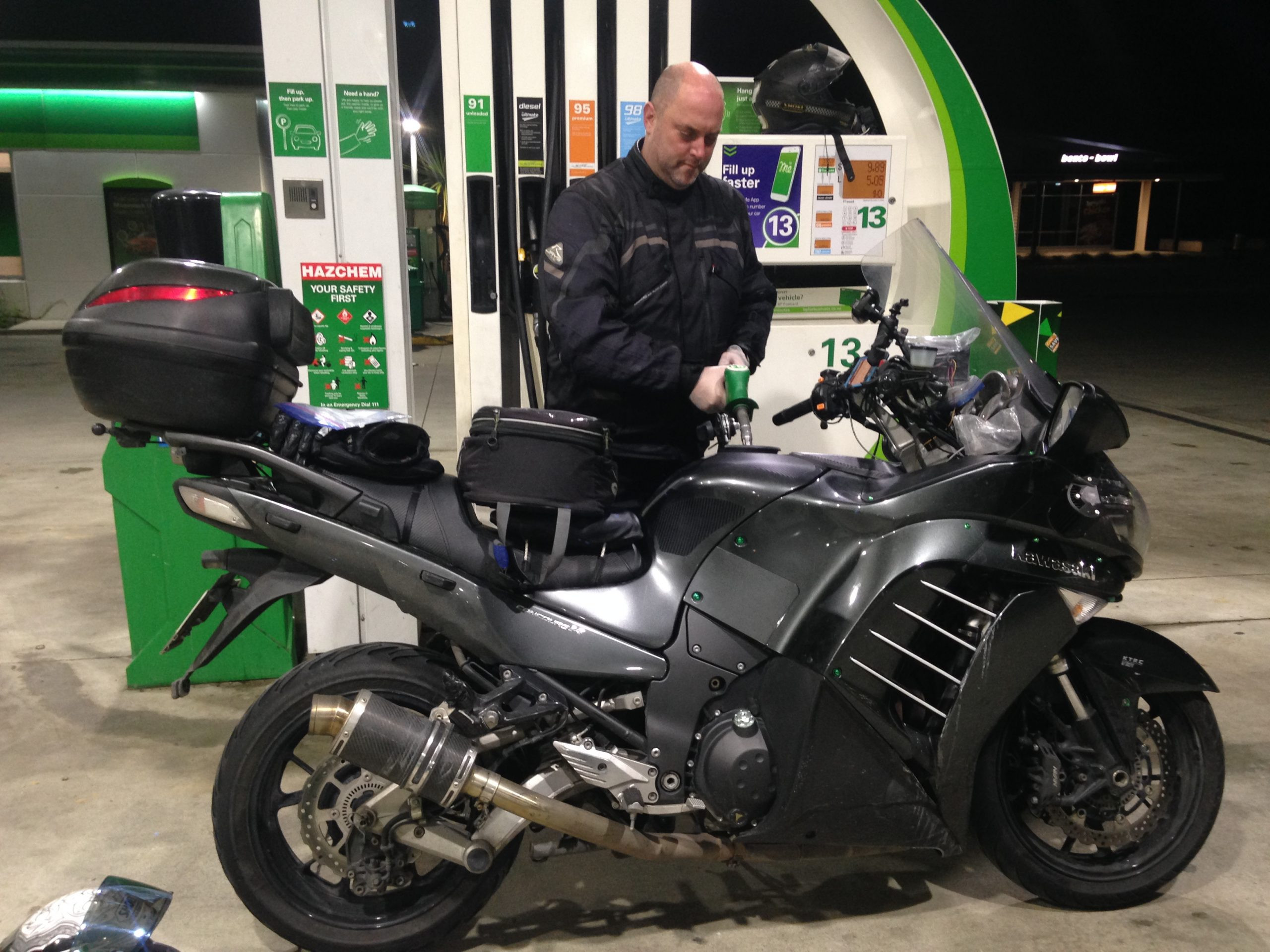
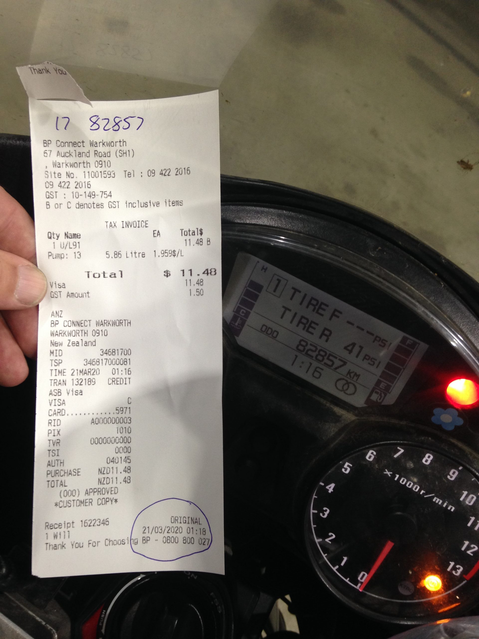
Refuelling at Warkworth for our official starting receipts and ODO readings.
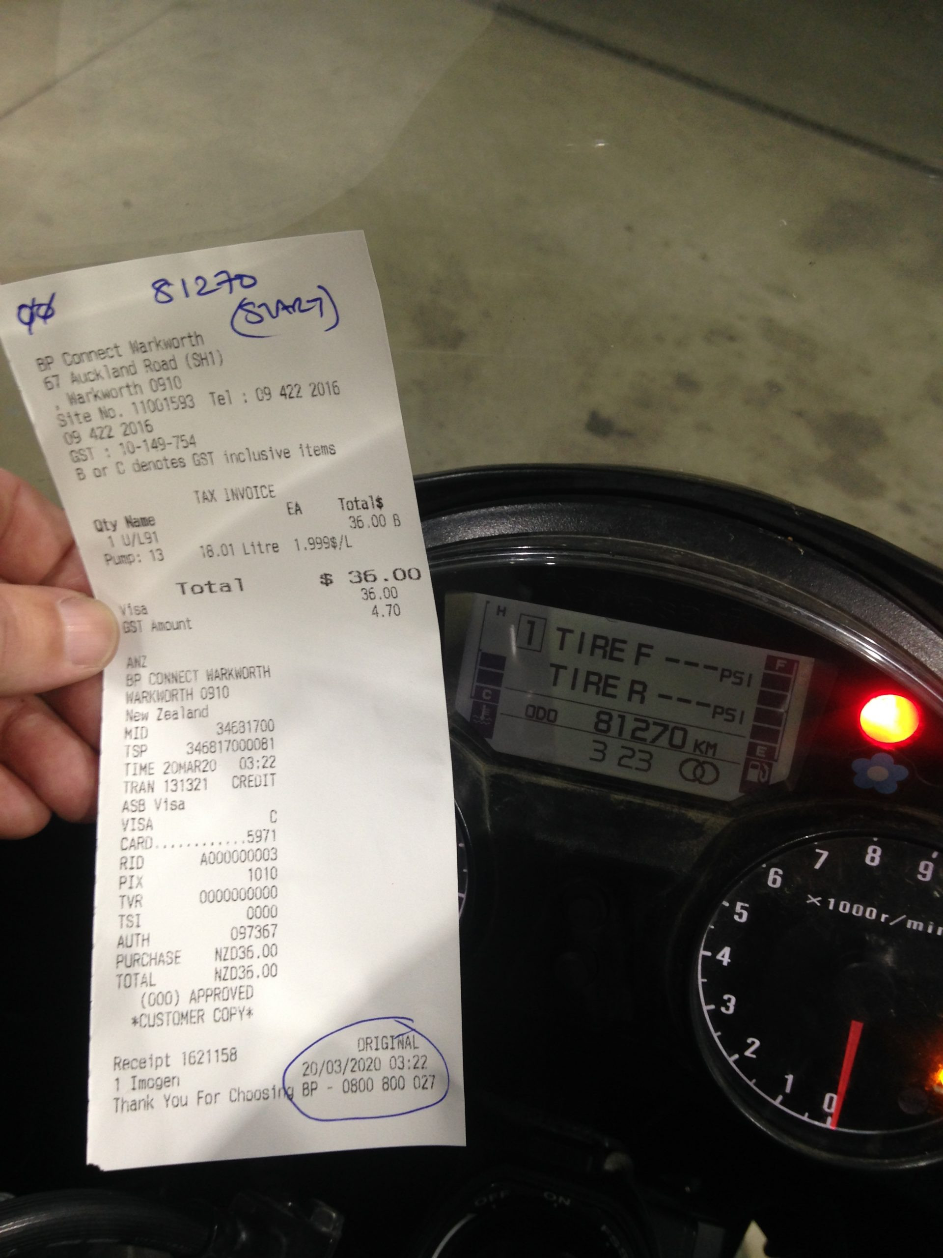
C14 official ‘start’ receipt and ODO

ZX-14R official ‘Start’ receipt and ODO.
Initial Checkpoints
As we left Warkworth, we were bang-on time leaving at almost exactly 03:30am, and despite this, the GPS had us 2 minutes behind at our first checkpoint.
We quickly settled into a riding pace as we were heading down from Warkworth and into the Auckland area. Immediately our TomTom Go’s started to tell us about road closures on SH1. The first of which appeared to be at Greville Rd on the North Shore. We discussed our approach, expecting to have to ride up Greville, through back-streets to Constellation and back onto SH1 there. Luke and Tania had noticed work trucks on the motorway on their way up to Warkworth, so we thought that they must have put that road closure into place while they were up, further North.
We pulled off SH1 at Greville, and noticed a car entering onto the motorway at Greville, southbound. Well, if he can do that, then so can we… So we simply went around the junction and back onto the motorway, ignoring the suggested diversion. – No problem, so we just carried on, nothing came of it, so they must have either been setting up, or pulling that down. We got through it.
Further south, at Titirangi, there was another closure from there to Papakura. We weren’t so lucky with that one, we did have to get off the motorway and do an urban road route between those junctions. All up, this messing around put us approximately 12 minutes behind our schedule.
Further south, beyond Bombay and onto SH2, heading Eastbound, it became clear to me that the changes which I had made to the GPS route-speeds on the secondary build of the GPS files had made a significant difference. Riding at a healthy pace we were not able to draw back against those lost 12 minutes, not initially, not while we were on SH1 or SH2. SH2 has a good portion of it as a ‘safer speed zone’ too, so we had to be respectful of that – which further impacted our ability to get that ETA back on track.
When we hit the lesser, SH25A we were able to start to make some progress. We had clawed some time back and were only 3 mins behind. We stopped for a little longer than we’d planned (you almost always do on the first stop, it’s the first chance you’ve got to adjust those things you need to while you’re settling in)… Anyway, by the time we had left there we were looking at about 7 mins back from our plan.
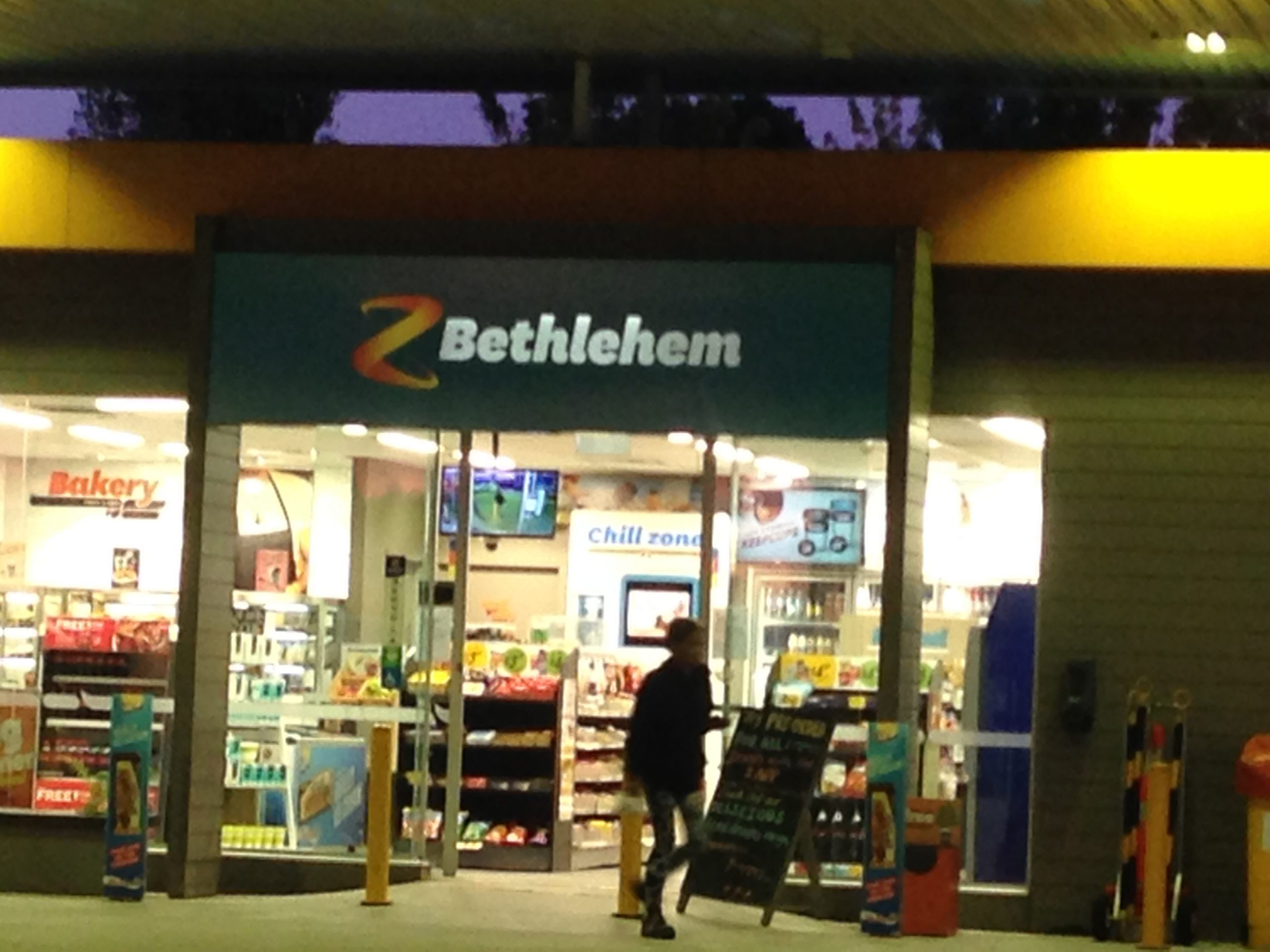
It was still dark as we were coming into the second checkpoint. Heading down SH2, towards Tauranga, this section of road is also heavily speed restricted too. It started raining properly on us as we were nearing Bethlehem, so we stopped for an unscheduled stop in the local Challenge station, just to change gloves, and for Luke and Tania to put on their highly visible rain gear.
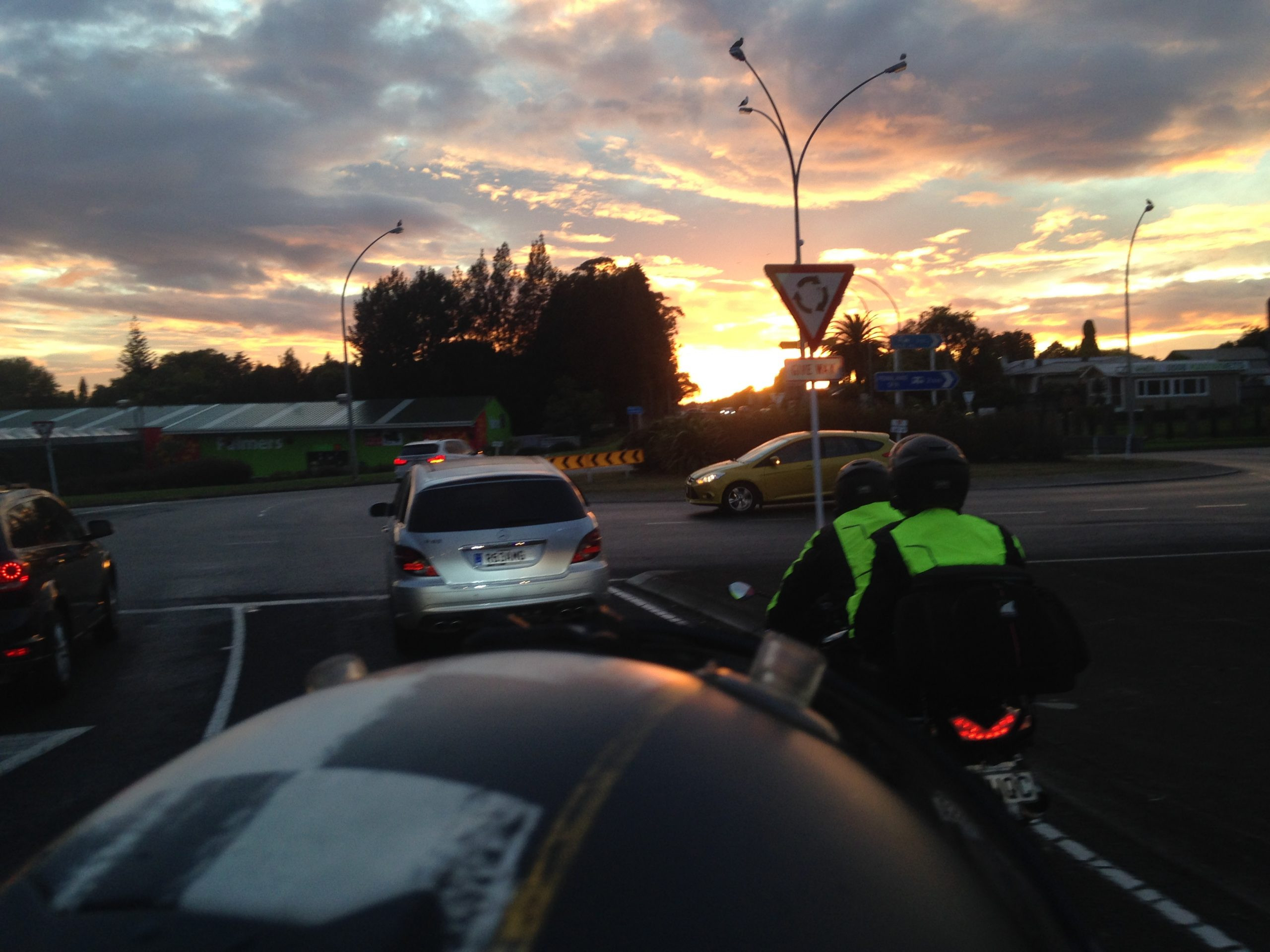
We’d made a good degree of progress up until that point, but that stop had again pushed us back a bit. I recall we were about 15 or so minutes behind coming into, and 13 behind leaving the Z Bethlehem checkpoint. The sunrise as we were leaving that stop was spectacular, Stella managed to do a good job capturing that with her iPhone while we were riding:
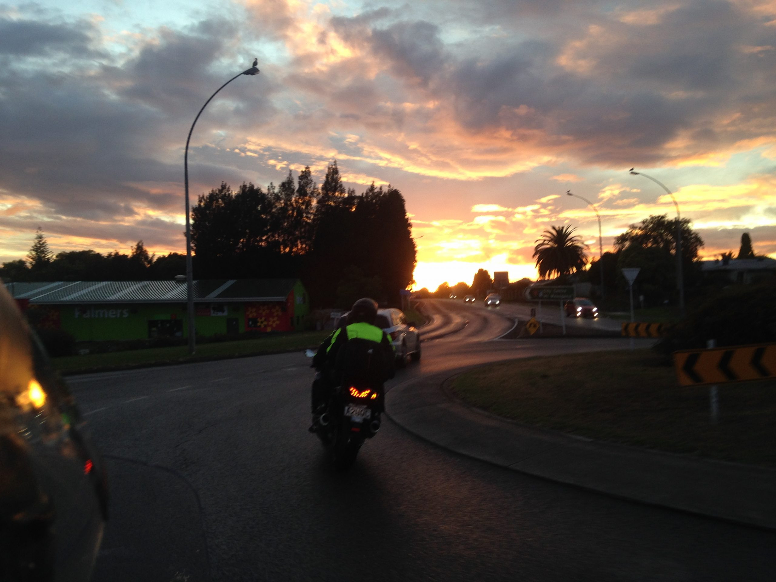
The westerly, cross-country route between Bethlehem and Te Kuiti contains three, static speed cameras. All of our navigational gear contains those locations, and we spotted an additional camera van too along that route. We don’t habitually speed, and so this isn’t an issue for us, but it is good to be aware of where they all are. I had begun to feel pretty tired in the nigh-time riding on the way into checkpoint 2, so the daylight came as a very welcome relief for me. Finally my body rhythms changed to a more awake and alert state. I started to feel good and the riding become more natural. The wet, dark roads had been a challenge to keep up reasonable, and safe speeds and to remain smooth. I think the milky coffee drink I had helped a bit too.
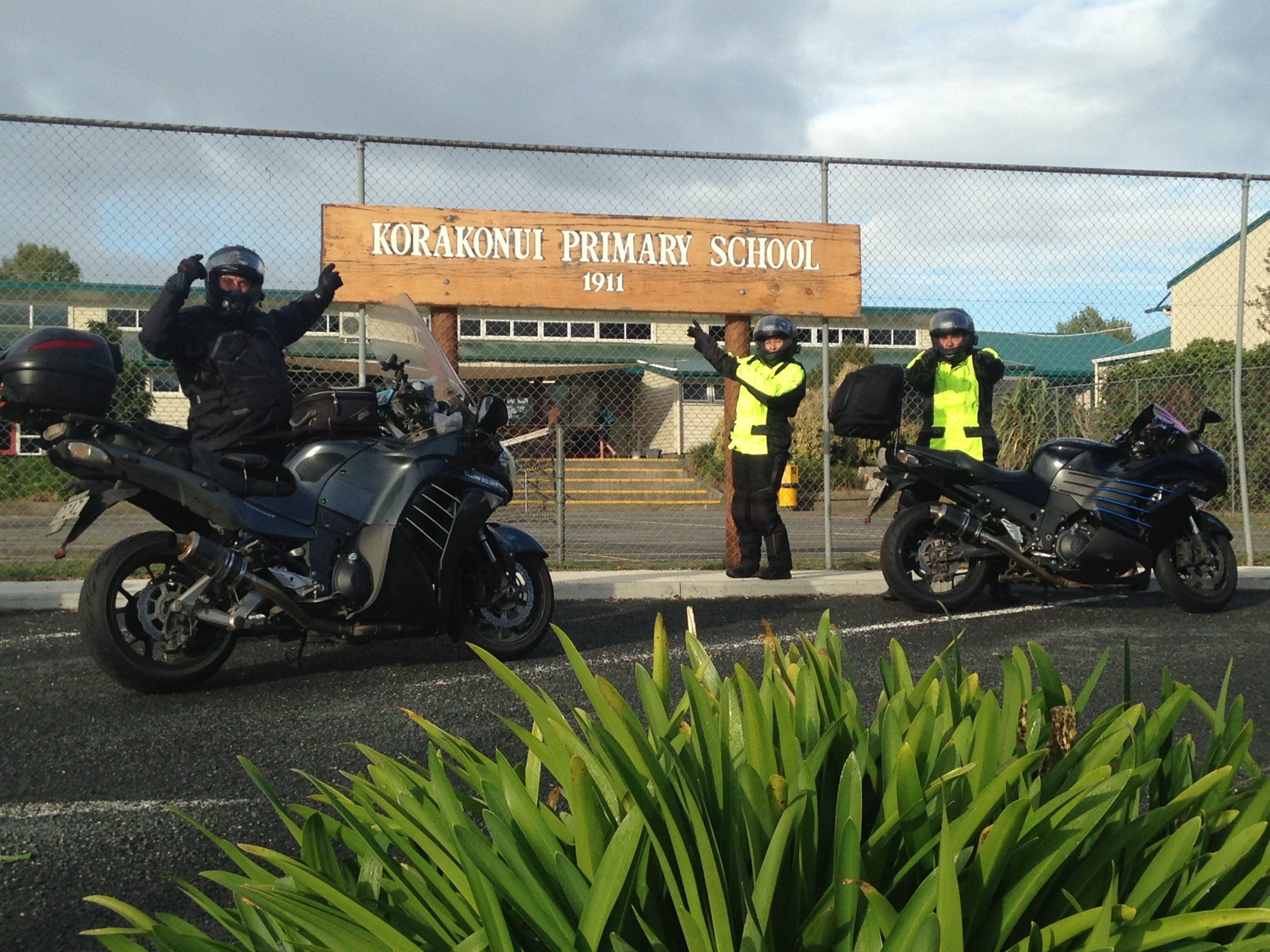
Just after Te Awamutu, we had added in a back-country loop for the extra distance and to pick up the Korakonui Primary School checkpoint. Initially we had planned this as just a straight out and back from the state highway, but this was more fun. The roads were patchy wet in spots, and some were covered in patches of roadworks and dirt too, but this was nothing compared to the NI800 ride in which all three of our riders had pretty massive slides in the shiny tar sections when they got wet. We arrived at the school checkpoint 13 minutes behind our plan. Some of the kids were in the playground and being dropped off, and came over to have a look at our bikes.
South of Otorohanga, we took another detour off the main highway, and south via some back-roads parallel to the main SH route (blue on the map). We did this to honour John Maroulis, and his route excellent route planning skills, and his love of small twisty (ridiculous) back-roads.

These were not much more than goat tracks at points, but they were fun. We had pushed those roads into the route simply to avoid going down and back up the same section of state highway and for us to be kept a little more ‘honest’, offsetting some of the other NI1600 route-cuts which we’d made. – We arrived at Te Kuiti at 09:29am, 14 minutes back from our plan.
It was clear that our planned timing was reasonably accurate and didn’t allow for much in the way of gathering any time-in-hand. All things considered at this point, we were very happy with progress since we had dealt with road closures, rain and wet patches. We also had to keep four people content at each of the stops we were making too, as you’ll all know the more people you have involved in these things, the longer you always end up stopping for, it’s the slowest common denominator which sets the stopping rates (all fine and accepted), we were all absolutely as good as we could be, and we did have tasks and duties split up at the fuel stops and checkpoints…
South of Te Kuiti, we got to redo a really nice section of road, probably Luke’s favourite of the day, SH30 between Te Kuiti and Whakamaru – through Bennydale. We’ve loved this section of road each time we’ve done it, both the road and the scenery along here are pretty special.
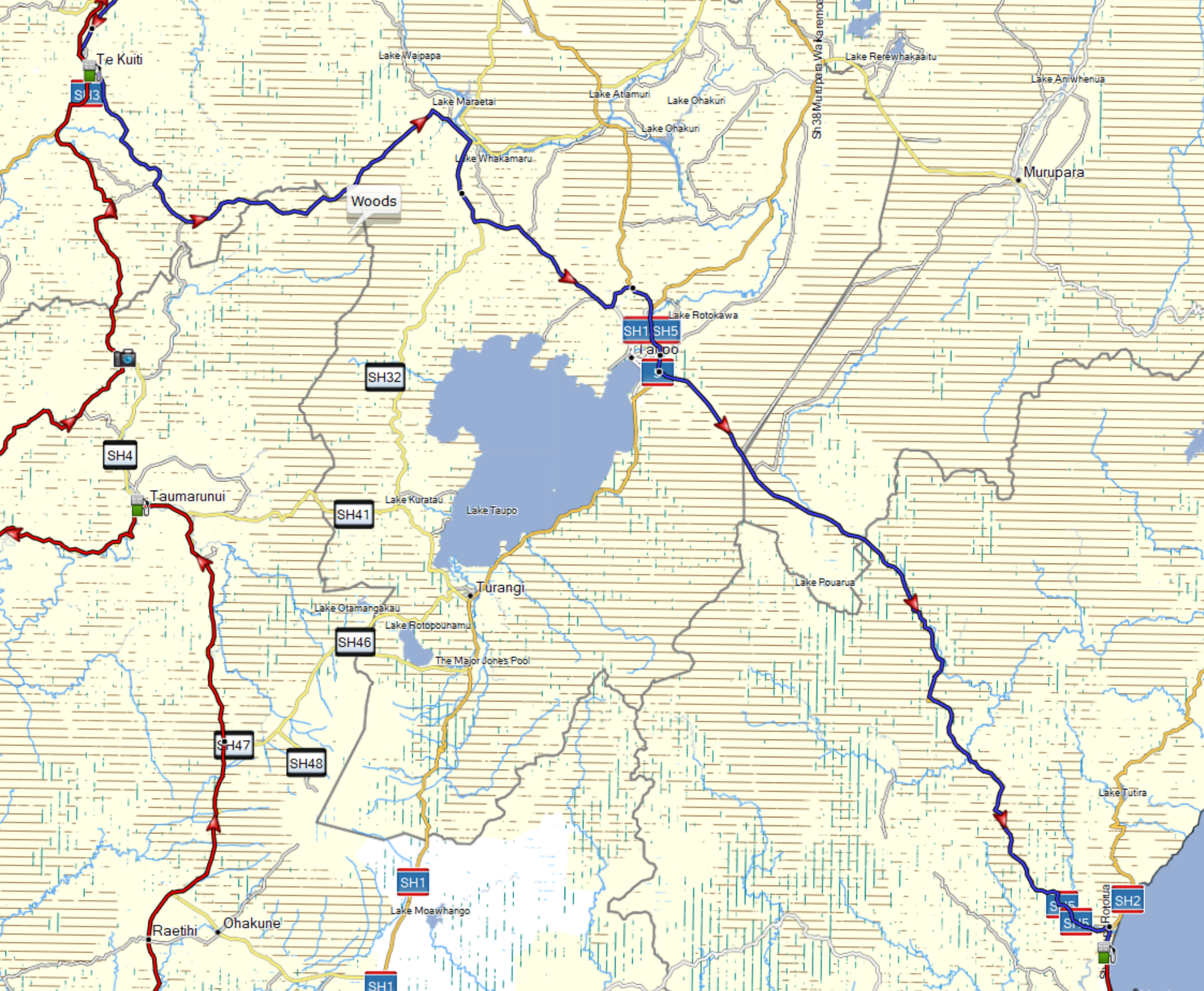
Beyond Whakamaru, we joined SH32 for a brief period, then turned left (eastbound) on Poihipi Rd, across to Link Rd (North of Taupo), this was another new road for all of us, we’ve never done this one before. It was very pleasant, flowing with pretty scenery.
Around the north of Taupo, and onto the bypass, we had stopped and short-filled in Te Kuiti, so we didn’t need to stop at Wairakei, we headed straight over the Taupo-Napier highway and into Bayview. We filled up there at 12:30pm, only 10 minutes behind at that point. We ate Pizza from the top-box (which is not a euphemism), drank fluids and headed out, southbound.
Going through Napier and Hastings was heavy going. The road changes and road works which are going on there are highly restrictive, and sections of road that used to flow well on a motorcycle are now boxed in and overly constrained with single lanes and yellow-lines. This section was honestly – painful. Traffic was heavy too and we had very limited opportunity to make any progress through it. Only those short spurts of passing lanes after each of the numerous round-a-bouts provided some relief from it. You guys who live there are doing well if you’re able to remain calm through those modified sections of road!
Once we were south of Hastings, we were off the main roads again, heading out to collect two more checkpoints before returning to the highway:
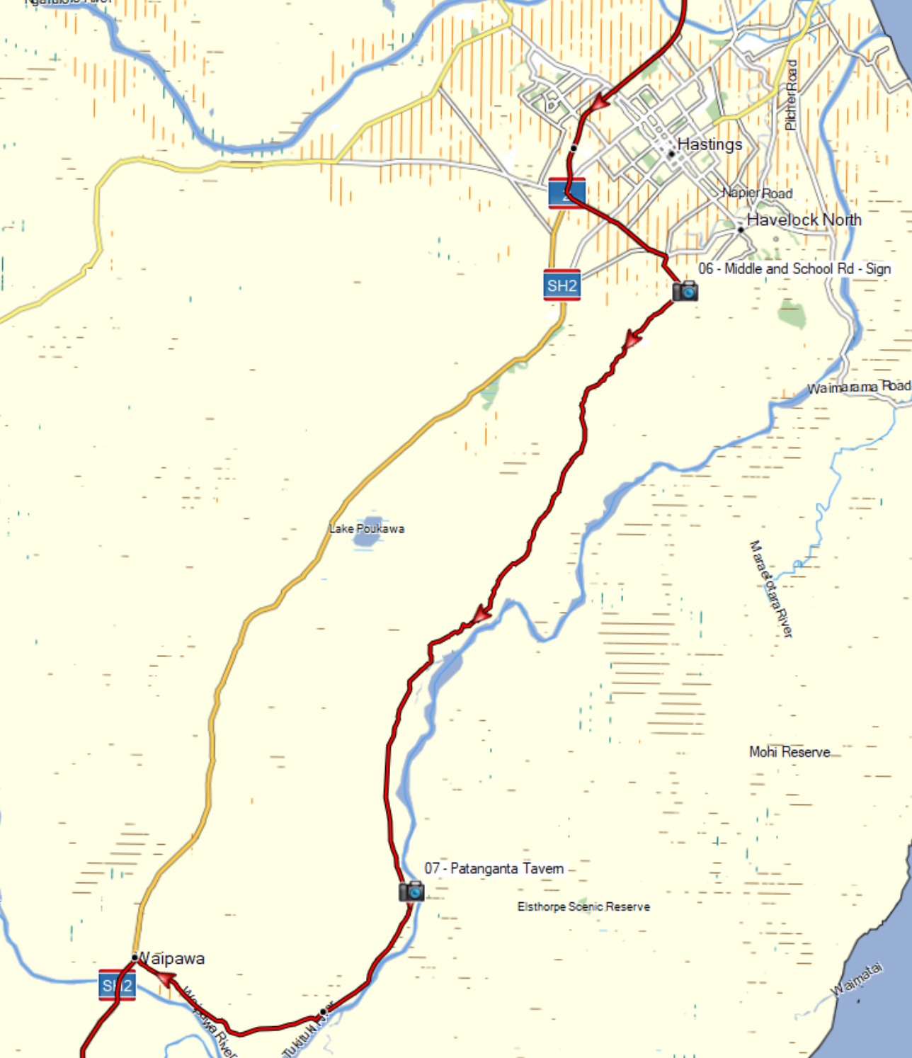
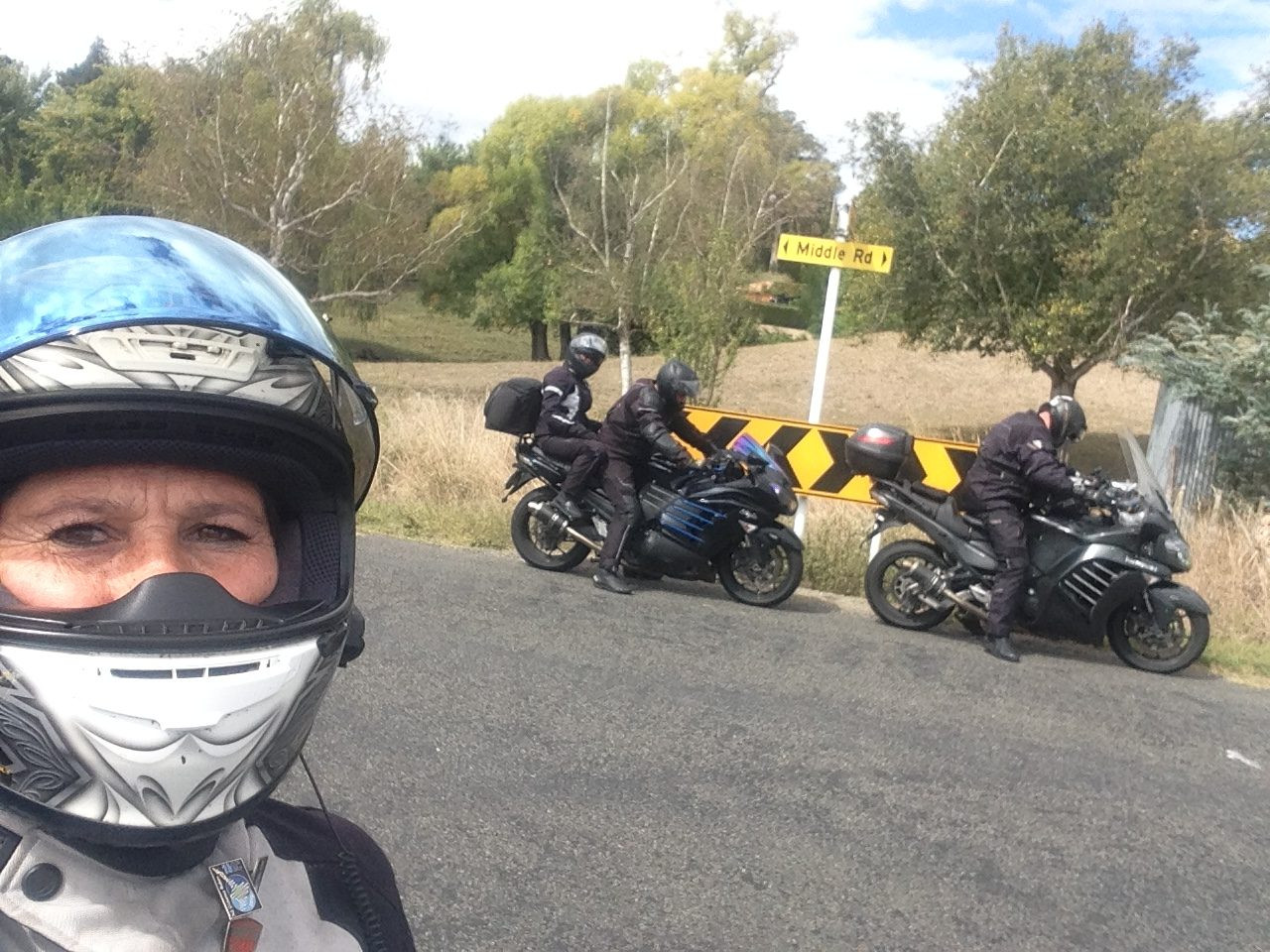
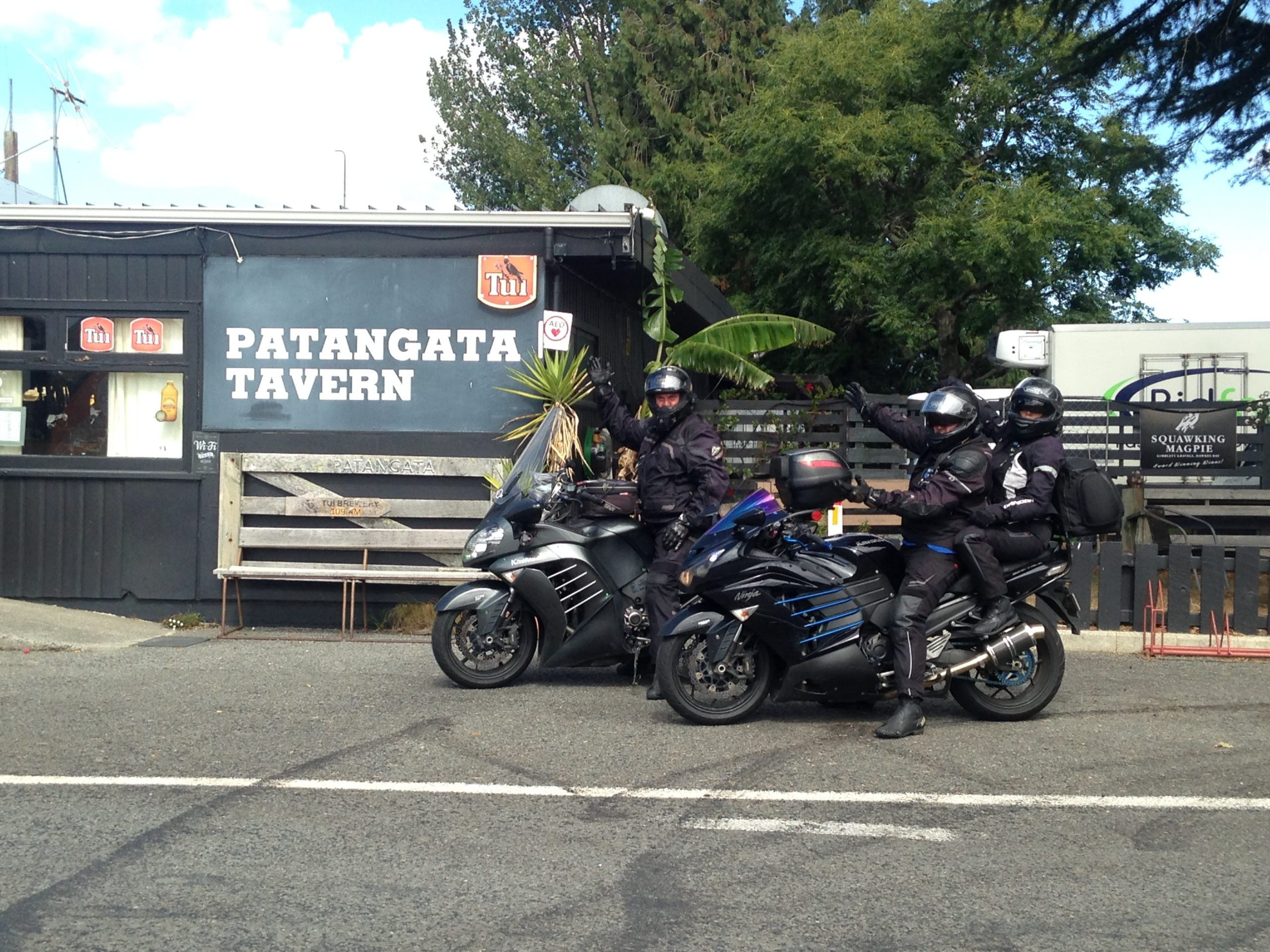
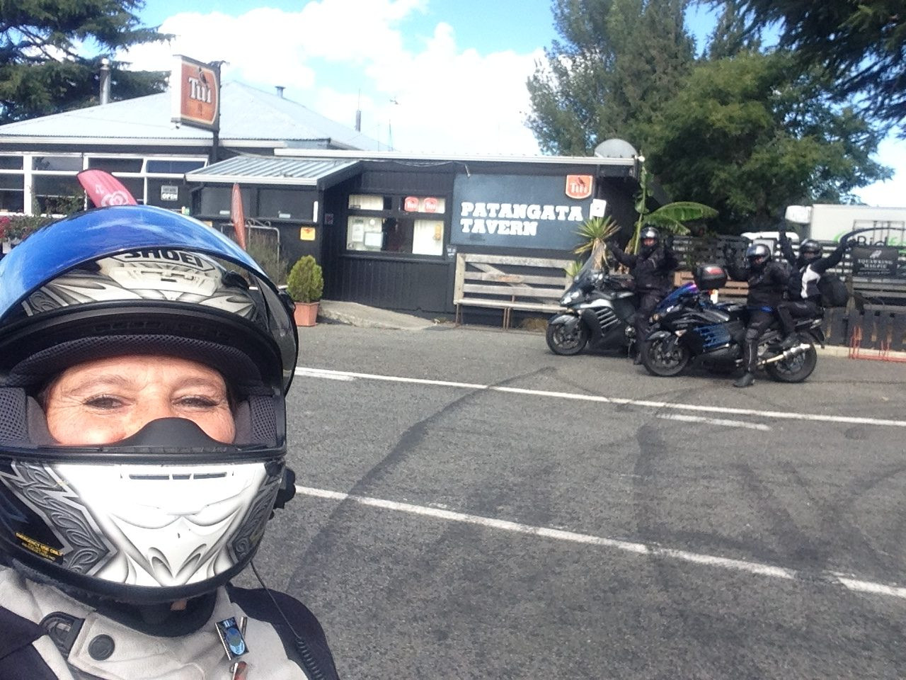
We arrived at the Middle Road and School Road checkpoint at 1:21pm – 21 minutes behind, all of that extra time was lost through those rubbish Napier and Hastings main roads. It was more of a nice, back-country blast through to Patanganta Tavern. Here we got to experience some local driving skills. Luke wasn’t all too impressed by what was on offer and found a non-verbal means to communicate his displeasure of someone across both sides of the road, cutting blind corners and just generally being thoughtless. The Tavern stop was 17 minutes behind schedule.
Waipawa, south ended up being more of the state highway, lots of trucks, mixed weather, wet patches. We stopped in Woodville to put waterproofs back on and it hosed down as we approached the Saddle Rd, across to Ashhurst. The Saddle itself was pretty iffy, we were on tenter hooks crossing that, partly due to the road conditions and it being damp, but there were also big wind gusts blowing us around up there too.
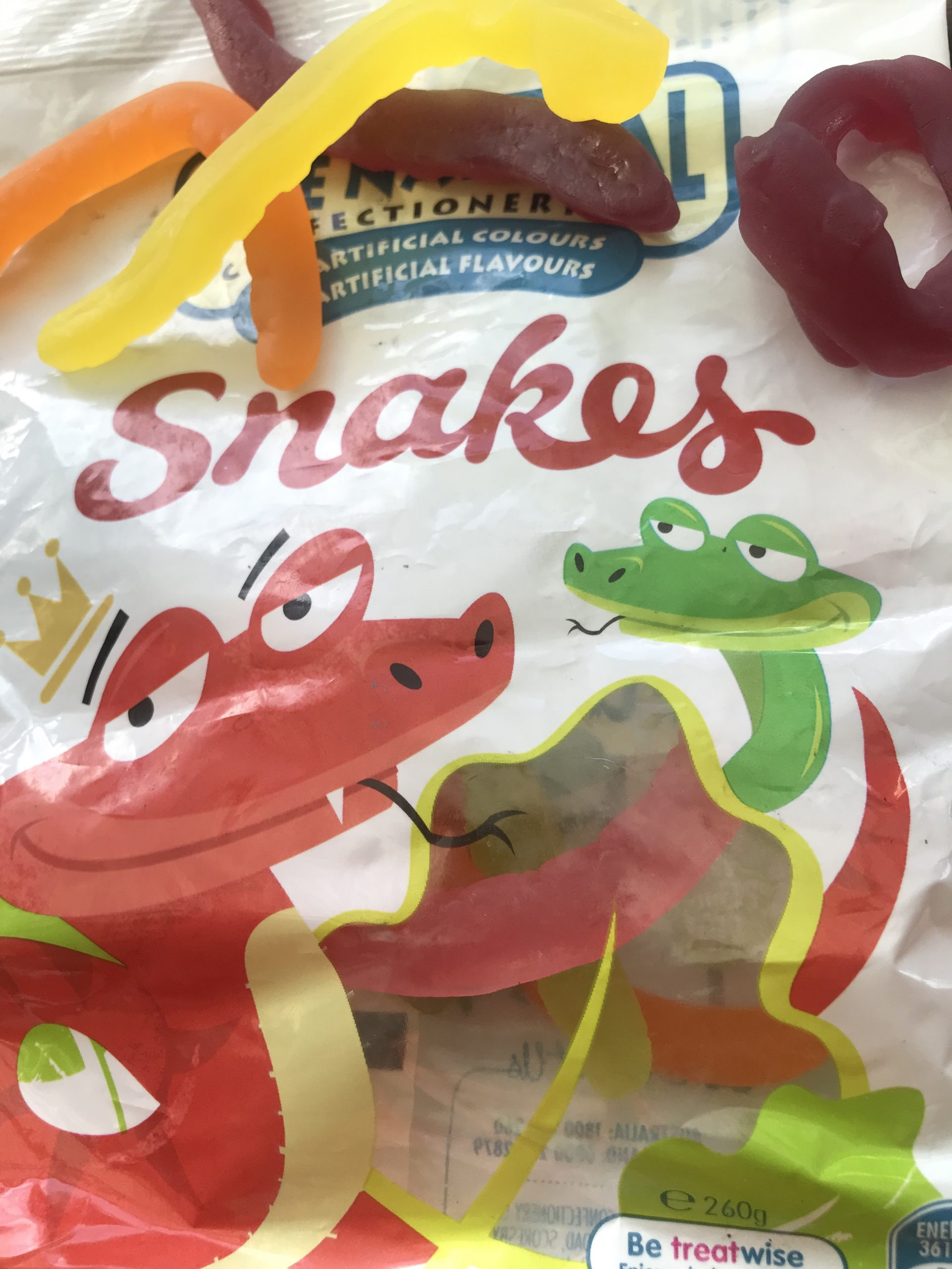
The roads south of Ashhurst are fairly straight forward, main roads the only additional concerns down there was the ongoing rain in patches. We were starting to get a little hungry as we approached Shannon so we planned to open up the bag of snakes and have a little snake feast when we stopped. We got there at 3:45pm. 22 mins behind. Again, reflecting on our progress at that point we were still happy with this given the rain and tough roads we’d just worked through. With regards to those Snakes, these things are amazing for LD rides, just 2 will stave off the hunger for up to an hour, and you don’t even have to remove your helmet to be able to feed them in…
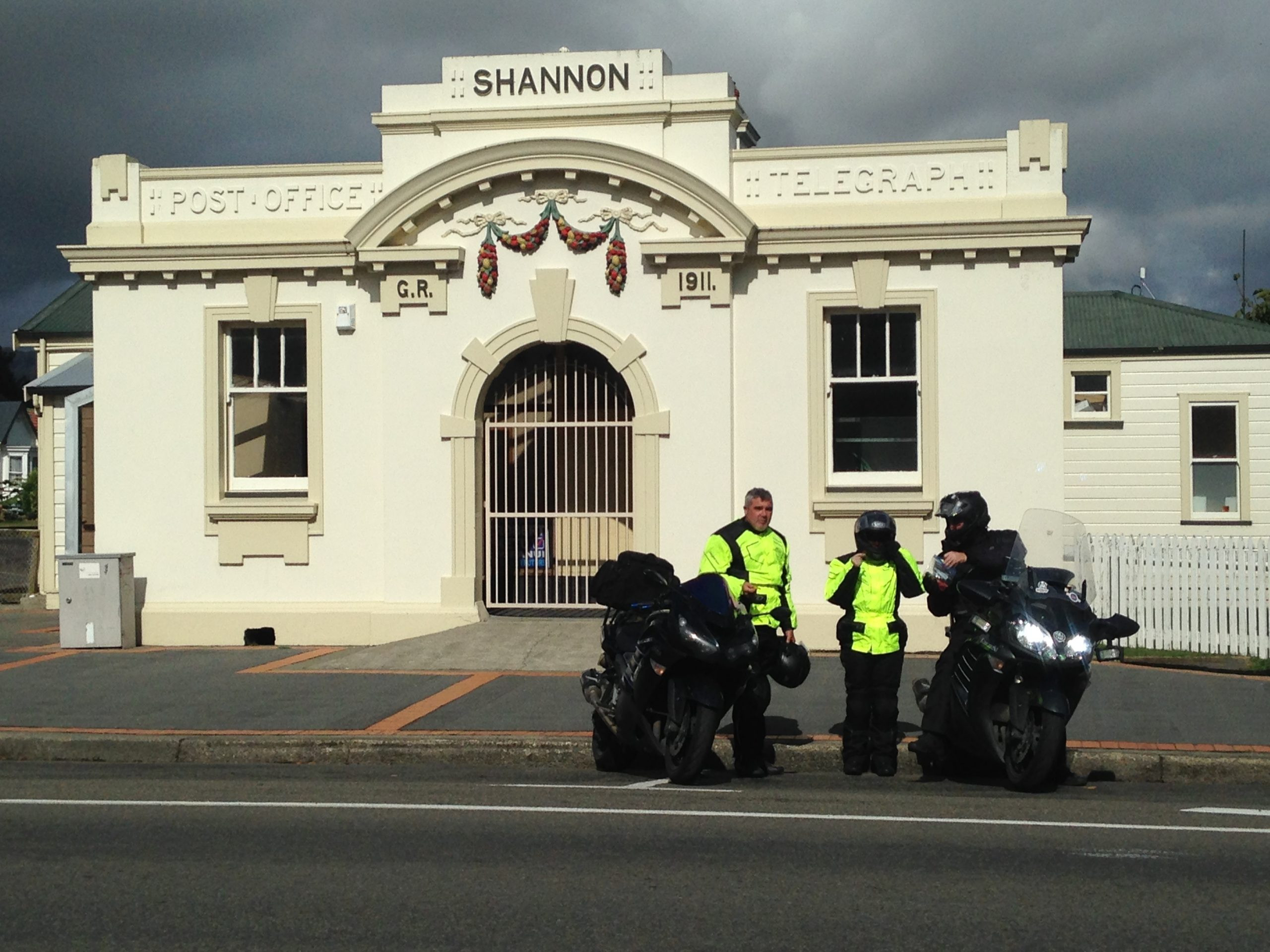
The old post office building in Shannon is a really nice old building, we were getting quite excited to see it and had been talking about how excited we were for at least 5 minutes before we had arrived there. I’m not sure how much of that was genuine excitement vs slight madness starting to creep in, perhaps it was a degree of eagerness to get off the bikes for a few minutes?… Everyone was still in pretty good spirits, there was not overly tired grumpiness, no complaining from either of the pillions or the riders, we were doing well and having fun.

In fact, we were so chatty one our way into Foxton that we missed our bypass-route turning and ended up going right into Foxton and down the main-street. This error would have cost us at least 3 minutes since the traffic along highway 1 was heavy, schools were out, and the guys in front of us at that junction were really making close to zero effort to pull out.
Back on SH1, and up towards Sanson, this is consistently a highly policed section of the country, not that it would cause us any concern, because we don’t habitually speed, and so we were fine. Regardless, it is good to know where they are… My radar detector is actually quite good at finding them for us. Through to Bulls before we stopped for another fill and something to eat. We were 21 minutes behind as we pulled into Bulls.
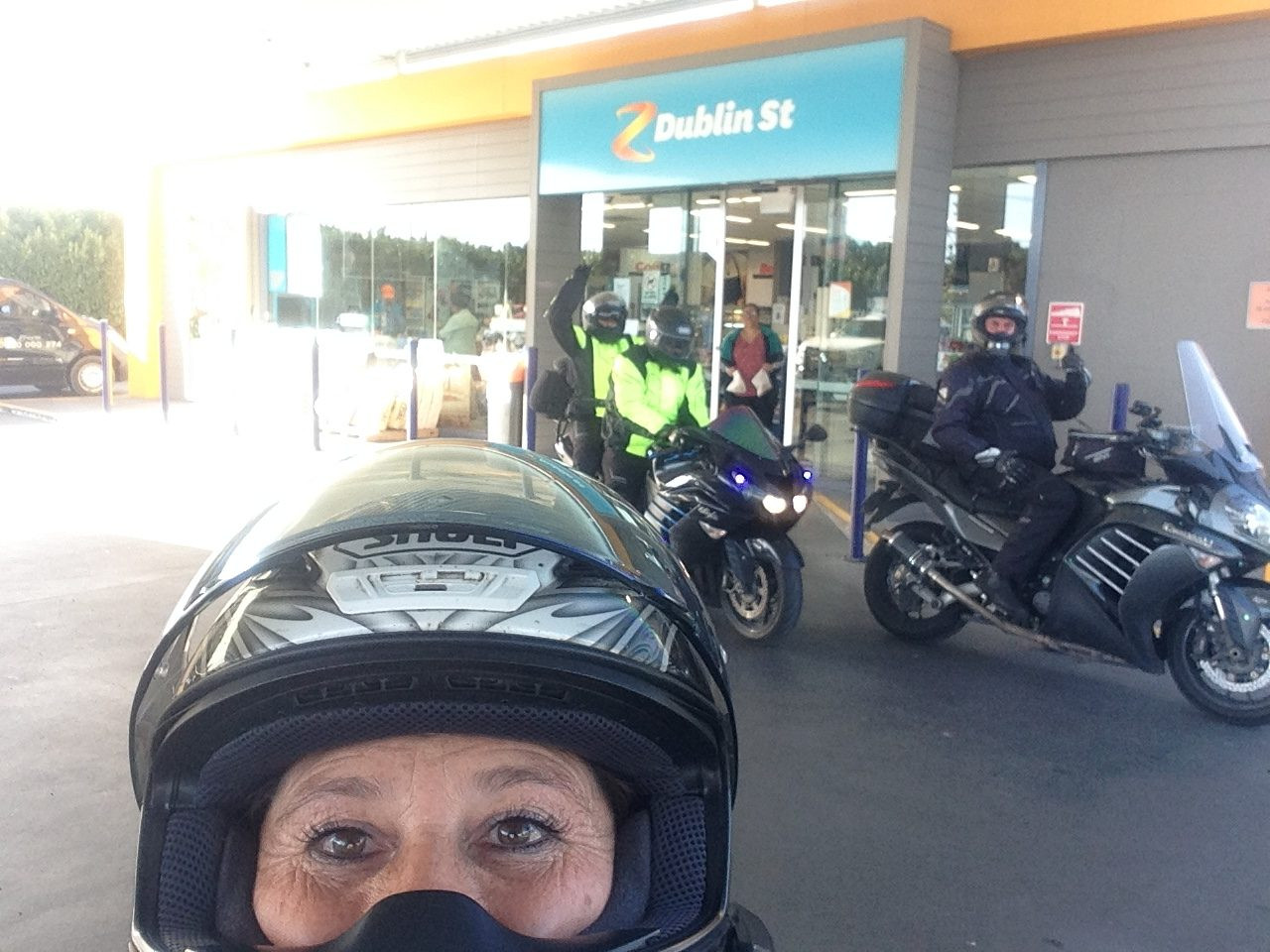
After all of the common conveniences, we were on the road again heading towards our next checkpoint in Whanganui, Z Dublin Street. This is again, a routinely highly policed section of road and again it didn’t disappoint. We managed to navigate our way over to Whanganui without any incident, arriving 21 minutes behind the plan.

I should be clear here, we were not directly aiming to remain 21 minutes behind, we were just riding at the same consistent speeds which we commonly do, and that’s just how it fell out as we moved along the ride. I was conscious, as we headed up the Paras that this would make us later than expected through the Ohura loop – a rural section of road which none of us had ridden before, so this would now fall, properly after dark.
We had a great run up the Paras, with little traffic holding us up. The road all the way up there was dry and the sun was out. It had turned into a really pleasant evening. We got to Taumarunui only 9 minutes behind our plan. We were super happy! Our plan was to stop briefly, use the bathrooms, grab a coffee then head out.
That’s not how it happened…
The Drama
The stop in Taumarunui didn’t go to plan, the first part did, we filled up with petrol and shifted bikes forward to the parking spots while I went inside to grab a drink and pay. When I came back out, as we were all standing around, it was just before dusk, the light was perfectly good enough to see a pool of bright green glycol coolant resting in the rim of my front wheel.
The issue
Glycol coolant is super slippery, I know this from my racing days; they banned glycol coolant in race bikes because one major leakage could shut down a whole race meeting. It’s also highly distinctive given its almost fluorescent green colour. I know not to ignore it. Whether this had just been on the floor, or on my wheel I would have thoroughly investigated to make sure that it wasn’t coming from my bike. In this case it was.
I had taken a direct hit from a stone on the road which had created a small puncture in the radiator. It must have just happened, there was a small pool at the pump where we had been parked, and a larger pool over in the parking area. I don’t believe that it had pressurised and leaked while we were riding, I think the normal riding temperatures of my cooling system are low enough that this only became an issue when the coolant had stopped flowing, and the residual, built up heat in the engine block then had time to transfer into a more localised volume of coolant. At this point, while stationary, I think it had started to build up pressure and had sprayed onto my brake lines, down onto my brake callipers, then dribbled into my front wheel’s rim.
To *know* where it was coming out from, we checked the level in the reservoir to make sure there was still sufficient coolant in the system to run the bike (it was fine), then we started the bike up again, we found the bubbling, squirting spot easily. It was just above the top of my radiator guard. That guard covers all but the top 2 inches of the radiator, the hole was within millimetres of the top of it.
Well, we all thought, that’s that then… Then, I remembered that the Taumarunui BP had a mini-Repco inside of it and that it might be worth running inside to see if they had any ‘Bars-Leaks’ (radiator repair fluid, that can act as a gunk to block up holes in radiators). Stella and Luke came in with me and we found that they had not one, but five choices, at which point there was a glimmer of hope. – Not knowing which of these was the best option, I chose to grab my phone off the bike and to phone-a-friend. My ex-racing partner Greg was able to offer us some excellent advice, recommending the ‘Prestone’ option above others, saying that his son, Alex had found that to be a strong option when he’d used it in the past.
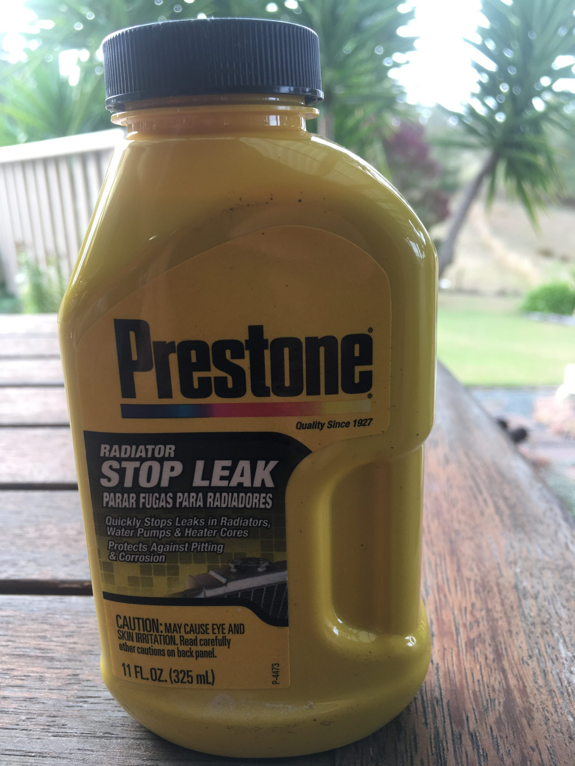
Greg is an industrial chemist, he knows his shit, he’s also a highly intelligent person who’s able to think laterally and has a world of experience to offer. He also suggested that I look for Araldite, and to slap some of that onto the hole. Again, we found not just one choice, but multiple varieties to choose from, we went for the 90 second option – because we were still on the clock. 🙂
Thank god for Taumarunui BP!
The solution
Armed with our goodies, we set about pulling my bike to pieces in the BP car-park in order to reach the radiator. This bike is NOT designed with easy road-side repairs in mind. We had to strip off: the tank cover, the RHS upper fairing cover, the RHS upper fairing and then separate the RHS upper, front fairing, from the front, inner fairing – just to reach the radiator cap. – No kidding…
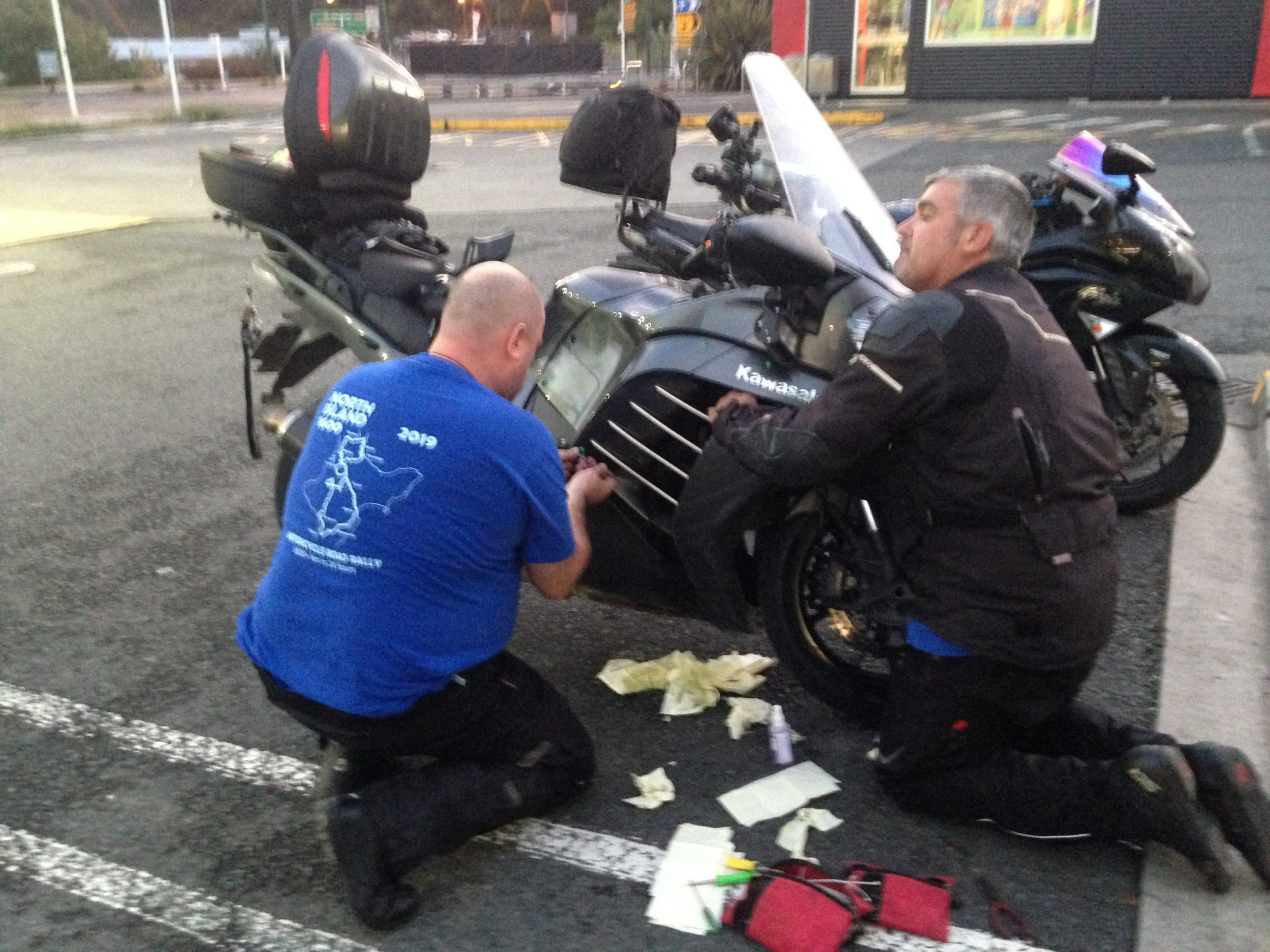
The first step in the plan was to drop the radiator fluid down, beneath the repair area, so that we could clean it, and dry it to apply the Araldite. To do this, we had to remove one of the larger radiator hoses and drain a reasonable amount of the top of it.
Cleaning it took a while, the Glycol is pretty persistent and needs a fair amount of additional clean water to encourage it to dissipate. It was everywhere…

Drying a radiator with paper towels is near impossible as the little wholes all fill up with water. We needed a cloth to make any progress drying it.
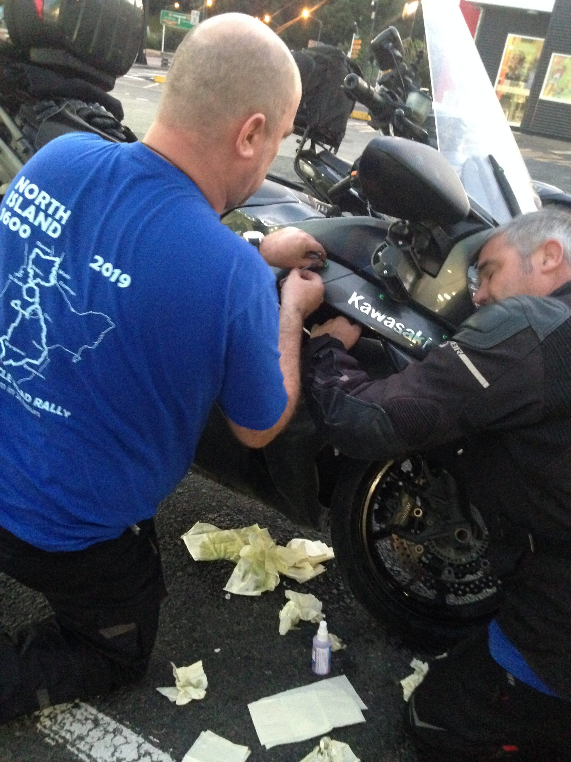
Through all of this, it was starting to get dark.
So then we mixed up the glue and slapped it on… Then gave it 89 seconds to cure. – We were still on the clock… I used all of it, I’d forgotten where the hole was (we should have videoed it).
Meanwhile the hose was put back on. We bought a $7 funnel from the BP which we fought with to try to position it into place through the fairings which really weren’t allowing us proper access. We dumped the entire bottle of Stop-Leak into the funnel. It clogged. The funnel had a filter mesh in it which got instantly blocked by the crap in the Stop-Leak. The funnel was in two parts so we carefully removed the top part then poured the mix into the secondary part of the funnel. It slowly flowed into the Radiator. We had let enough fluid out of the radiator, it all went in.
We checked the Araldite it was impressively solid, so we filled the rest of the radiator up with water from the BP watering can and then capped the radiator off.
The instructions on the Stop-Leak tell you to run the engine for 15 minutes to allow the goop some time to block up the hole. We started the bike and watched the engine temp rise very quickly. – This isn’t normal so we pulled the pin quickly and stopped it from running. We had a team meeting on this and I checked the radiator temperature by hand – finding it was cold to the touch. – We had fluid in the system, it was to the level of the radiator cap, the reservoir had plenty of fluid in it too. No heat was being transferred into the rad. We realised that we must have an airlock and that the water pump might not be pushing water, just spinning in air… We took the cap off again and started to manipulate the larger of the hoses on both sides of the bike, we could see the level in the rad drop at a certain point, making us think that we had shifted an air-lock.
I was happy at that point to start the engine up briefly again, with the rad cap off, and to see if we could see movement and variation of the level through the open radiator. – I blipped the throttle a bit and we did see the water level vary in the rad. This was the confirmation we were looking for. So we again topped off the radiator and capped it off again.
We took a deep breath and started it again. The temp was showing 5 of 5 bars still at this point. The thermo reading is taken from the water jacket in the engine block… When we started it again, within maybe 3-5 seconds, it dropped from 5 down to 2 bars. Phew! OMG, Phew! We hadn’t cooked my engine.
We stopped the engine again and all took a deep breath, we also took that opportunity to make lots of very relieved noises.
I checked the rad temp again with my hand, and it still felt cold to the touch… Clearly we’d just managed to get water to circulate but we hadn’t at this point proven that we’d got any heat exchange to work, nor had we proven the fluid levels, or the integrity of the hole / glue / gunk repair. – We still had a fair bit to work through – but we hadn’t cooked my engine! …
Once the nerves had recovered sufficiently we gave it another go. This too was nerve-wracking, it heated up again to 4 bars before the thermostatic valve opened, allowing water to circulate out, and though the radiator. – I’ve chased cooling issues before in my MR2, so I have a good understanding of the typical cooling water circuits in a basic engine. I know that it initially circulates just around the engine, until it reaches a certain temp, at which point a mechanical, heat sensitive value opens up, and shifts the flow to include the radiator. Well, this is what was happening during this test. Allowing it to get up to that point while watching it was tense. When it finally opened up and kicked in, and when we could finally feel it circulating through the radiator, it was good. The temperature reading dropped straight to 2 bars again.
Shortly after we had it fluctuating between 2 and 3 bars. This became a regular cycle. The fans would kick in and blow air across the radiator, it would drop down again, the fans would stop. Rinse and repeat…
We postulated (which is a very big word for this time of day, given that we’d been up since before 3am) that we would be unlikely to experience much else while parked in the car-park because clearly the cooling system was capable of keeping the bike’s core temperature down below that which would potentially boil and build up pressure within it. It takes stop/start riding to commonly do that, which we were unlikely to be doing… We did check the radiator for continued leaking, and could find nothing of interest.
Ok, so. – had we fixed it? – We thought we might have.
We put Warkworth into the GPS, and found that for us, it would make our finishing distance 1,601km (not enough for a SS or the NI1600 – you need 1,609+km as these are based on 1000 miles), but we would have enough by the time we rode the extra 23km to home.
This was enough for us to consider what our plan was. At 9:08pm I called John Maroulis to tell him our story and to discuss options. He was surprised that we were out riding, he’d thought we were doing all of this on Saturday not Friday… Regardless, when he heard that we had done 1235 / 1255km respectively and that we had just spend 2 hours working through a radiator repair in the carpark of the BP, he was quite supportive of the idea that we might not want to continue on directly to do the Ohura loop. For us, this was a potentially a big risk, bigger than we wanted to expose ourselves to at this point in the day.
We had multiple outcomes to consider, the most basic of which was that we didn’t want to get stranded on a minor back road, without cellphone coverage and a dead bike. Not knowing if this repair was likely to hold, we wanted to head straight for Te Kuiti – not only did this keep us on the main road, but it also meant that we were heading closed to home without delay. John agreed that we should ditch those checkpoints and just get on with trying to get home, and or finishing the rides. He gave us approval at that point, given what we’d just worked through that if we did make the distance in the time, that it could count for our Double Badger ride. This was great news. For us, it made things much simpler and provided strong hope that if we could get home, then we could finish these two rides.
For us, the IBA Four Seasons ride would have had to have taken priority over the NI1600, just given that was the last of four chained certificates. Thanks to John, this meant that if we got back at this point then he’d consider our 1600 ride done too.
First, we needed to get the bike back together. Stella had been an excellent help with the ‘hold this’ job, with all of the bolts we’d removed. We didn’t lose a single one. Everything went back in as it had come out, and by 09:30pm we were back on the road. By our reckoning at that point, we would have about 1:30hrs spare within our 24 hour period, from leaving home, to get back there, within our remaining time. – This might perhaps be just enough to run through another round of repairs. We bought another bottle of Stop-Leak for the top-box and headed out.
Getting it done
Initially we had planned to go 5 minutes down the road, stop and have a quick check. Instead as we were riding I kept a close eye on the temperature gauge, it was doing the same thing, it would vary between 2 and 3 bars, not going any higher than that. Luke was riding behind me, following away from my direct line in case I was spewing coolant out onto the road. He was keeping an eye out for moisture on my rear tyre. I was being super careful along the road, especially entering corners. Early on, I tested my brakes a few times, I had plenty of grab available. We just took things super steady for a while. We decided that stopping on the side of the road in the dark when nothing seemed to be wrong would not be as useful as getting through to the next major town (Te Kuiti) and having a more decent look at the radiator in the strong lights of the fuel station. So we pressed on to the BP in Te Kuiti.
We had been battling to keep the intercoms going, as they don’t last the whole 24 hour period without a recharge. It also turns out that when you start charging them, if you’re connected when you plug it in, then it interrupts the current activity. – If you’re charging on the go, with a dodgy connection then it’s terribly unstable. This is what we were trying to work through while we were riding up form Taumarunui. Tania was the ‘last one in the chain’ and that position appeared to be the most affected throughout the day. She did incredibly well to keep calm and to patiently work through reconnecting herself throughout the later parts of the ride.
When we got to Te Kuiti, we stopped for a decent check of things and it all seemed to be perfectly fine. We pressed on as quickly as possible without filling up.
We ditched a total of four of the NI1600 planned checkpoints, one in Ohura loop, another at the SH4 and two more west of Hamilton. We made a bee-line to Bombay service station which was our last planned checkpoint and planned fuel stop before heading to the finish at Warkworth. We checked the repair again there and it continued to look good, no signs of any fluid coming out through the patch. We got into the BP at Bombay at midnight. 1:15 hour behind our plan (we’d saved 1:15 hrs by removing those other checkpoints).

We were quite tired at this point, but all still pretty happy with how things had panned out. On the ride up through the Auckland’s Southern Motorway we were expecting to see some further road closures but thankfully we didn’t get any. On the approach to Auckland we had a fresh look at the mileage done on the GPS trip view and it was still as it had been projected from Taumarunui. Luke and Tania considered their options again in more detail and decided that they would continue on, North of home for a while, but perhaps not go all the way up to Warkworth, as it appeared unnecessary, by that point we were all fairly confident that the bike ought to be able to get us home, so we no longer needed the company and supervision which we’d benefitted from a little earlier.
They came up as far as the last exit prior to the toll-road section of the Northern Motorway, we could just hear some commotion over the intercom as we were riding away from them as they struck a rabbit on the loop back over to head south! When they got back down toward home, to be safe on the mileage they continued another junction past home, then looped back up again to Constellation and popped into the Z station there for a final, backup-fuel fill and receipt. Just to top off their day the station was unmanned and the pump didn’t dispense a receipt for them.
Meanwhile we continued up to Warkworth, and in their normal typical fashion, they became the only station in the entire trip to insist on something none-standard from all of the other BPs used in the whole, entire trip. – This time the overly official ladies manning the station insisted that I remove my helmet before they would open the pump. I had no choice but to comply. When I went to pay they gave me some lame reasoning saying that it was their policy and their rules which required me to do that for them. I told them that I could accept that if they were consistent about it, but since they weren’t, I took exception to it. They defended that by saying that the reason for the inconsistency would only be because of poor training of ‘other staff’. I’ve had issues with this station on a number of occasions with lame bullshit power play rubbish. Our license plates are automatically checked by character recognition video surveillance systems in these BPs, they are automatically notified of drive-off risk / histories. I am a BP card user and a regular customer across all of these sites and these guys need a proper kick up the butt for their behaviour. – They’re not all like this, the lady we had in that station the night before, when we left was really pleasant, friendly and helpful.
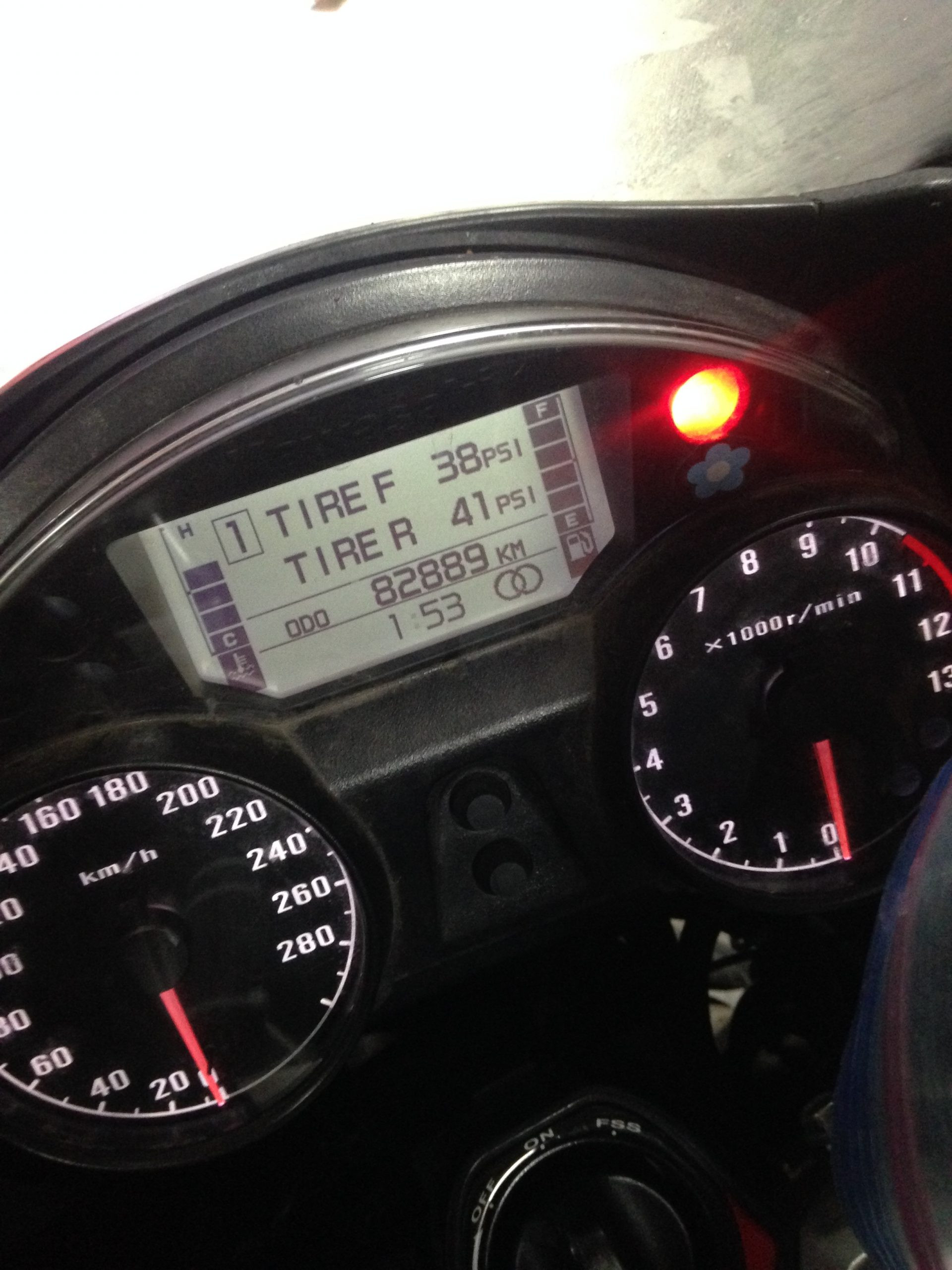
Anyway, I digress, sorry. – We got in at our final fuel stop in Warkworth at 1:15am, against a plan of 00:07am – Not a bad result. We had completed just over 1,601km on the GPS, we would need the extra milage getting home to make this an IBA compliant ride. We checked the spot tracks again, and both Stella’s and my tracks had worked all the way round, without any interruptions, we were both very pleased with that.

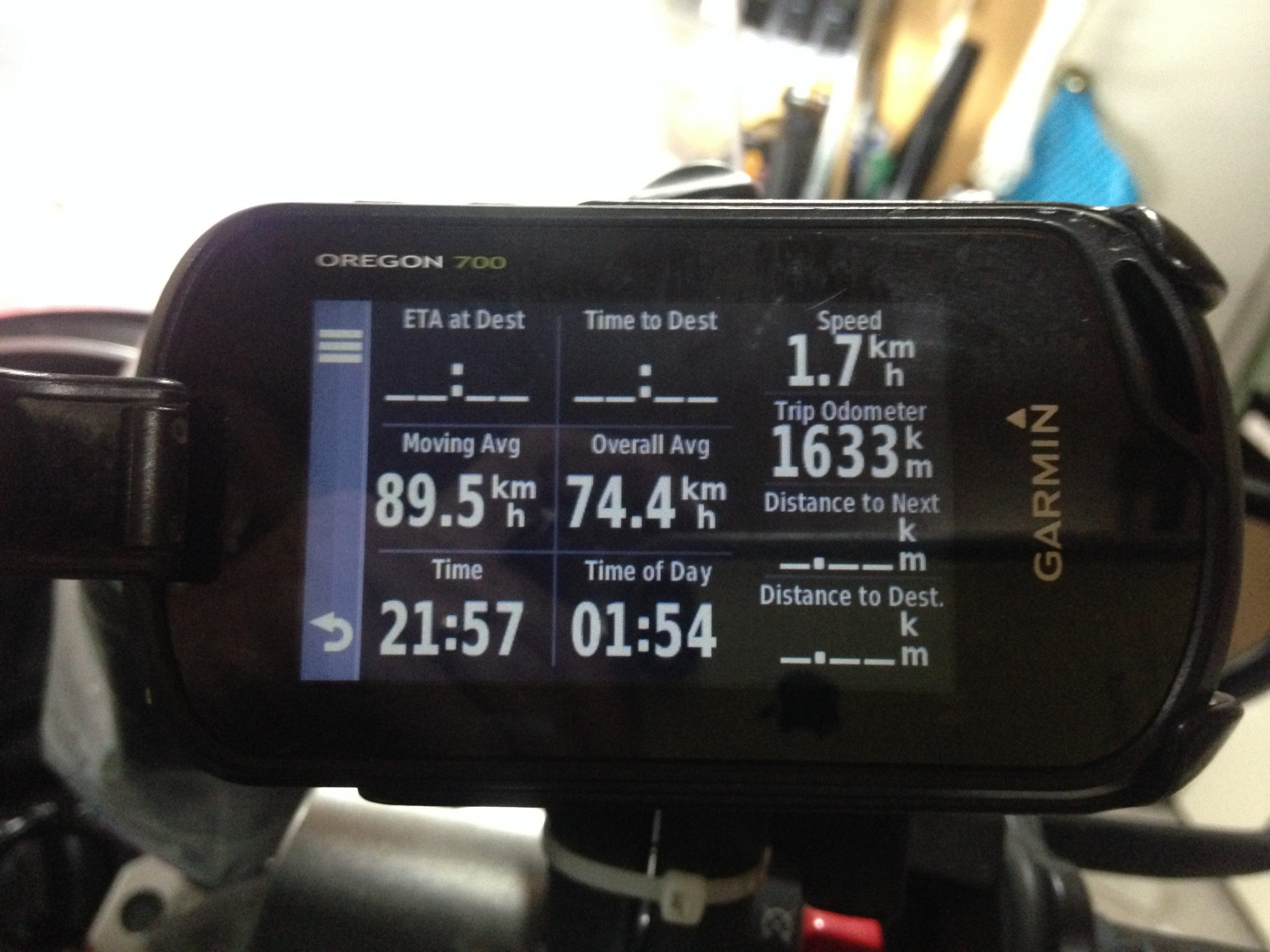
We left Warkworth and began the final 23km home, taking things nice and steady. We would have left there just before 1:30am. As we neared home, Stella and I agreed that we should over-shoot our road turning and continue on another ~5km to SH16, drop a Spot point, then return home. We added on another ~9km to our overall route and made it home by 1:54am. This was 23:04hrs after we had left, and we’d clocked up 1,633km by our GPS’ trip computer.
We got unloaded, into the house, and made contact with Luke and Tania to tell them that we’d made it home, we swapped stories about out final few kms which we’d both done, apart. Had a celebratory beer and wine, chatted for a bit, then called it a day.
Ride Summaries
Luke’s SWConnect based SpotWalla track had also worked flawlessly all the way around. – I’ve been saying to everyone recently, if you can get a fully in-tact SpotWalla track, then it makes the ride verification super simple, the IBA have tools to turn SpotWalla tracks back into routed, road distances, and the dropped location and time points can be trusted to show the timing involved in covering that milage. I have included our two, routed SpotWalla Track reports here:
Chris and Stella : (Showing 1,629km in 22:59hrs)
Luke and Tania : (Showing 1,617km in 22:45hrs)
For the sake of certification, we’ll use the smaller of those two distances – 1,617km.
A note about COVID-19
When we went to do our ride, we set about it cautiously, with our own personal protections (gloves, hand-sanitisers, alcohol cleaning spray etc). Stella and I had a routine at petrol stations to ensure that we minimised both our own personal risk, and also that which we might introduce to others too. I need to be clear about this: when we did the ride, it was a day *before* NZ implemented our Alert based system, and a day before we all entered into ‘Level 2’ of that system. When we did this ride, there were no restrictions on movements, there was just a simple recommendation that people ought to practice good personal hygiene and try to keep a degree of personal distance from others.
When we did this ride, it was still considered to be perfectly reasonable to be out-and-about, and trying to keep supporting businesses, to be spending money etc etc..
Would we be doing this same thing right now? – On the day which I’m publishing this (24th Mar)? No. – A lot has changed in the last 4 days.
For now, we’re all supporting the #StayTheFuckHome movement. Things will return to normal, but it will take time. While we’re dealing with the pointy end of this, we all need to simply understand what is important, and to help those who are on the front-lines, by not doing anything which would potentially put them, or our health system at any risk, or strain.