I have helped to develop a system which takes SpotWalla tracks, analyses them, and turns them back into routed, summarised distances.
SpotWalla is a fantastic tracking system, it’s live, real time, secure, and easy enough (I believe) to tell if a track has been doctored and tinkered with. – It’s also very power-friendly for your mobile phone, to use a Spot Tracking app to log your movements, as it only polls for a new location every 5 minutes or less.
There are a number of things which make this service perfect for use with the IBA, and for the majority of their ride tracking requirements.
However, one thing which has historically been a little challenging is to take a track and turn it into a properly road-routed distance. This is especially important in countries where the roads are super-twisty, as a significant amount of your milage can be lost if you’re using straight line measurements between 5 minutely logged points.
So, I wrote a web based system which can take a publicly shared SpotWalla track (a Trip), download and import the details of the tracked points, then feed them through a routing engine to obtain road based routing details and road based distances, across legs of the journey.
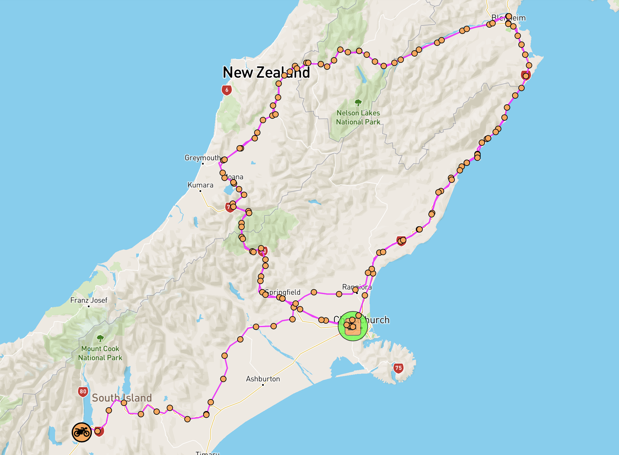
I’ve attached a sample output from that system for a ride which is currently underway in NZ, Julian Boyd’s BB2500K attempt on the Spring Equinox, here: [email protected]
This file has been compressed and the images have been deliberately reduced in quality to keep the file size small. But you get the idea… So, from this, if we trim the start and finish times to exactly the ride which you want to verify, we can use the summarised output for verification purposes. 🙂