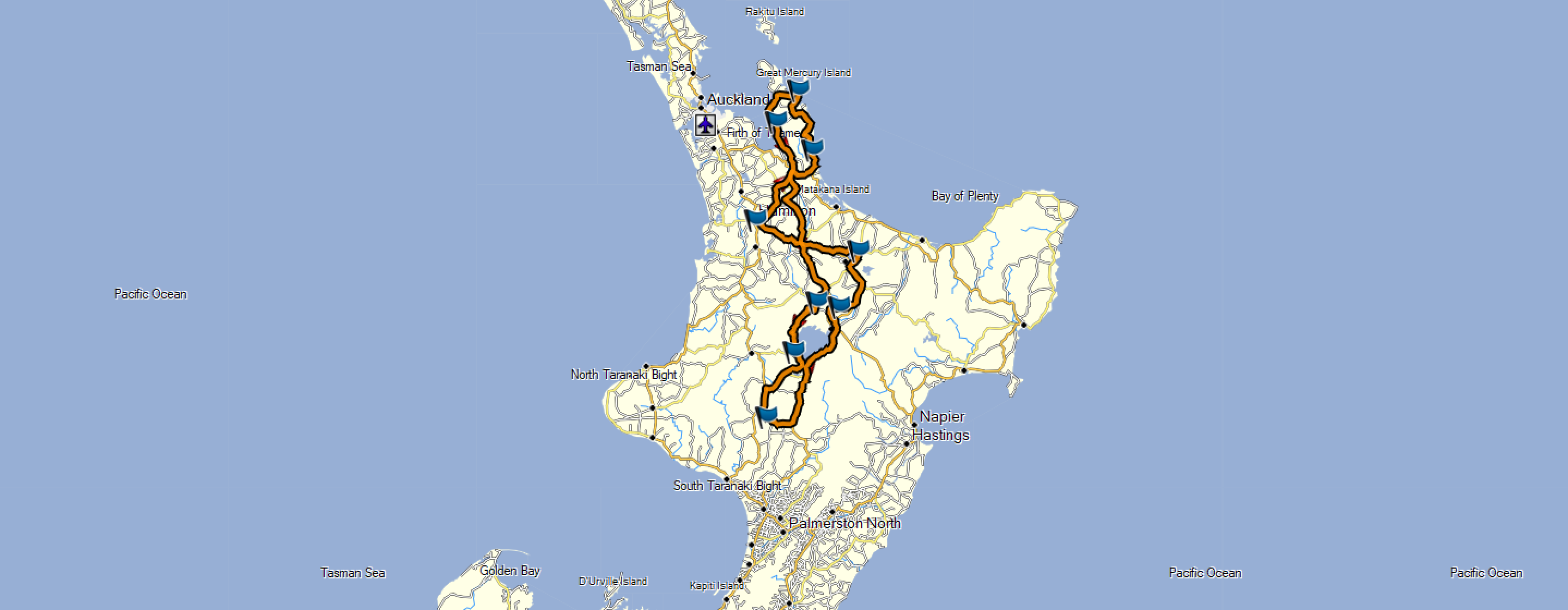
The NZ LD riders group have released their 1KC rider’s pack, including briefing, checkpoint details etc.
The checkpoint list is a series of named locations and photos which we’ll have to replicate when we ride around in order to prove our ride. – So next step was to jump onto GoogleMaps, and have a look at the street view images for various locations, there were only a few where the searched results didn’t yield the right location.
| Checkpoint | Coords | ||
| CP0 | Eastside Tavern | 37°47’38.5″S 175°17’35.2″E | -37.794034, 175.293106 |
| CP1 | Whangamata School | 37°12’58.0″S 175°51’57.6″E | -37.216096, 175.866010 |
| CP2 | Kuaotunu Toilets | 36°43’25.7″S 175°43’28.8″E | -36.723811, 175.724677 |
| CP3 | Royal Oak Hotel – Tapu | 36°59’02.6″S 175°30’06.0″E | -36.984052, 175.501662 |
| CP4 | Tirohanga School | 38°28’08.3″S 175°54’38.9″E | -38.468970, 175.910808 |
| CP5 | Kurutau Junction | 38°52’51.4″S 175°40’43.5″E | -38.880932, 175.678735 |
| CP6 | Ohakune – Carrot (from across the highway is fine) | 39°25’11.3″S 175°24’13.6″E | -39.419818, 175.403775 |
| CP7 | Orakeikorako – Sign for The Hidden Valley 5km | 38°30’41.8″S 176°08’07.6″E | -38.511609, 176.135454 |
| CP8 | Mourea Mini Mart | 38°02’45.9″S 176°19’48.4″E | -38.046091, 176.330116 |
| CP9 | Eastside Tavern | 37°47’38.5″S 175°17’35.2″E | -37.794034, 175.293106 |
Having read the riding / route instructions in more detail I can see that there are a number of smaller, not so obvious roads which they wanted us to take when heading south from Thames.
For anyone who doesn’t have time to do any detailed route planning of their own, but who wants something for their Garmin or other GPX, this file here should help… Hamilton – 1KC – 2018
Cheers,
Chris.